What is recorded here
Within the NE quadrant of a cashel (GA104-269----). The present access point to the Man-made underground passage, at the S end of Chamber 1, is filled with collapse and rubble; the depth of soil above its projecting roof lintel is 0.4m. The chamber (L >7.55m; Wth 1.55m), which is aligned NNW-SSE, is filled to within 0.65m of the roof level with cleared field stones. Traces of side-walls to the S of the access point indicate that it extended further to the SSE. A wall recess (L 0.85m; Wth 0.55m; H 0.5m) is evident near the N end of the W side-wall. The end-wall is curved. A short passage (L 2.45m; Wth 1.65m narrowing to 0.8m; H 0.7m) off the W side-wall leads to a creep (L 2m; Wth 1.65m; H 1.1m) with a drop-hole (L 0.75m; Wth 0.55m) that accesses Chamber 2.
Chamber 2 (L 8.1m; Wth 1.75m at end-wall narrowing to 1.65m at creep; H 1.7m) is aligned NNE-SSW. It is constructed of massive boulders and a corbel layer which support the roof lintels. The N side-wall curves while the S one is straight. The floor level rises to the NNE and is covered with some debris including one boulder which formed part of the creep. A short passage (L 2.85m; Wth at base of creep 0.7m; H 0.95m decreasing to 0.85m) leads to another creep (L 1.65m; Wth 1.5; H 1.15m) with a drop-hole (L 0.55m; Wth 0.55m) that accesses Chamber 3.
Chamber 3 (L 10.6m; Wth 1.9m at end-wall narrowing to 1.4m at creep; H 1.8m) is aligned NNW-SSE and is similar in construction to Chamber 2; massive boulders (L 1.5m; Wth 1m; T 0.25m) and a corbel layer support the roof lintels (Wth 1.2m). Both side-walls are straight initially but then curve towards the back wall which is also curved. The floor in this chamber appears to be original. (Holt 1910, 155; McCaffrey 1952, 67, no. 45)
Compiled by: Olive Alcock
Date of upload: 27 April 2018
The monument record does not grant public access. Check the route and ask the landowner before entering private land.
- What survives
- Recorded monument
Places near here
 Dermot & Grania's BedArchaeological place · 617 yd
 CaveMan-made underground passage · 1019 yd
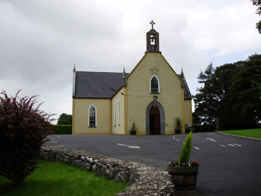 Saint Killian's Catholic Churchchurch/chapel · 1.0 mi
 Ballymanagh Ho.House, 18th/19th century · 1.0 mi
 CarnanthomasCastle, unclassified · 1.1 mi
 Cregg Castle (in ruins)Castle, tower house · 1.4 mi
 Moyard WoodWood · 4.1 mi
 Blake's IslandIslet · 4.2 mi
 Ash IslandIslet · 4.6 mi
 Kilcornan ForestWood · 7.3 mi
 Drumacoo Monastic SiteHeritage attraction · 8.9 mi
 KnocknarebanaMountain / peak · 9.4 mi