What is recorded here
An opening to a Man-made underground passage (KE087-056001-) is located in the external face of the bank at SW. The Man-made underground passage is stone-built, 20.7m in total length, and comprises five separate passages. These have a maximum width at floor level of 1.3m and are up to 1.9m high. Their walls, slightly corbelled, are of drystone construction and are roofed with lintels. The present entrance, .76m x .46m, gives access to the first passage, which has a slightly curved course in a NW direction. It is 6.2m long, and 1.2m inside the entrance, in the SW wall, is a small blocked ope which may have been the Man-made underground passage's original entrance. The second passage is separated from the first by a large stone slab which is secured between the roofing lintels and hangs to within .6m of the present floor level. This passage is 5.5m long and is the highest and widest in the Man-made underground passage. A narrow shaft, probably an air-vent, is located in its W wall at roof level. This passage and the remaining ones are aligned N-S. Access to the third passage is gained through an inserted wall with a lintelled creepway, .6m high, .6m wide and .9m long. The passage is 3.7m long and its floor slopes up towards the fourth passage, from which it is separated by a slab projecting from the W wall. The fourth passage is 3m long with an uneven rock floor. A horizontally positioned slab, located just below the roofing lintel at the passage's N end, marks the entrance into the collapsed fifth section of the Man-made underground passage. A large perforated slab located in the centre of the enclosure appears to overlie this section of the Man-made underground passage, and may have marked a second point of entry.
The above description is derived from A. O'Sullivan and J. Sheehan (compilers), 'The Iveragh peninsula: an archaeological survey of South Kerry'. Cork University Press (1996), no. 541. In certain instances the entries have been revised and updated in the light of recent research.
Date of upload: 29 July 2013
The monument record does not grant public access. Check the route and ask the landowner before entering private land.
- What survives
- Recorded monument
Places near here
 Óin / Man-made underground passageArchaeological place · 1 yd
 Ráth/ FortArchaeological place · 11 yd
 Séipéal na Cille [Killemlagh Catholic Chapel]church/chapel · 759 yd
 Tráigh na CilleBeach / strand · 918 yd
 Cuas a' PhúcaCave · 968 yd
 Carraig PhádraigCliff · 1065 yd
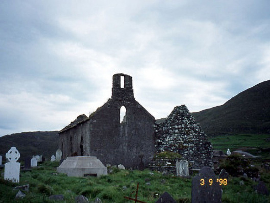
 Suíomh Eaglasta/ Ecclesiastical Site.Ruins · 1069 yd
 Cuas Dhiarmuid Uí FháilbheBay · 1071 yd
 Tráigh LeagaighBeach / strand · 1.0 mi
 Cúm an EaspaigMountain / peak · 1.3 mi
 Tobairin Holy WellSpring · 1.6 mi
 KillurlyMountain / peak · 1.6 mi