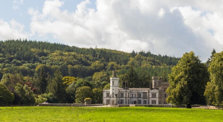
What is recorded here
On the moderately steep W-slope of ‘Pigeon House Hill’, overlooking a small W-flowing stream c. 35m to the S. A possible nunnery (KD027-025----) and graveyard (KD027-025001-) lie c. 120m to the WNW, and a church (KD027-027----) and graveyard (KD027-027001-) lie c. 125m to the SSW. The 1st ed. (1838) of the OS 6-inch map records the ‘Site of’ a second castle (KD027-028----) c. 180m to the ESE. In 1837, according to O’Conor’s Ordnance Survey Letter (Herity 2002, 145 (157)), ‘A small (part of the) ‘buttment’ of a Castle is to be seen … It is said that a family of the Fitzgeralds, originally had this castle in their possession.’ A very small portion of mortared masonry (1.5m N-S; 1.1m E-W; H 0.3-1.5m) with some inner and outer facing stones appears to survive in situ. A larger portion of displaced masonry (2m by 1.3m; H 1.6m) lies immediately to the S.
Compiled by: Gearóid Conroy
Date of upload: 10 October 2012
A local castle; wider significance not recorded.
The monument record does not grant public access. Check the route and ask the landowner before entering private land.
- What survives
- Recorded monument
Places near here
 Pigeon House RuinRuins · 26 yd
 O'Brienhouse · 62 yd
 Site of NunneryReligious house, unclassified · 124 yd
 Church (Site of)Church · 149 yd
 Site of CastleCastle, unclassified · 197 yd
 Brookfield WoodWood · 1.7 mi
 Derryvullagh IslandForest · 3.4 mi
 Japanese GardensHeritage attraction · 3.8 mi
 Irish National Stud and Japanese GardensHeritage attraction · 3.8 mi
 Tully Ho.Castle, unclassified · 3.8 mi
 Battle of Kilrushbattle · 4.3 mi
 Bithia Mary CrokerMemorial · 8.8 mi
Other information
Photo: Credit not shown in the picture search · Rights wording not checked; contact us if this picture should be removed