
What is recorded here
Castle, unclassified in Srath Bruithne Uachtarach is a flat grassy platform cut by a wide shallow ditch beside a fast mountain stream. Local memory points to an O'Boyle castle hidden in that valley, yet no wall or building mark remains on the platform. The ditch, river and absent east boundary suggest a defensive place whose shape water and time have softened into pasture.
Situated on low lying flat pasture in mountain valley on the bend of a fast running stream that runs along the S of the earthwork. Present remains consist of a flat platform (dims. 41.5m NE-SW; 24.5m NNW-SSE) defined by a scarp and wide-flat bottomed fosse (top Wth 7.7m; base Wth 4m; ext. D 1m; int. D 0.45m) which is only visible from W to N and by the river along its S side. There is no evidence of any enclosing element on the E side of this platform although the fosse may have been subesquently filled in along this side of the earthwork. The wide fosse may have acted as a water-filled moat providing a defensive feature along with the river to create a platform protected on its S side by a stream and on its other sides by a water-filled moat that feeds back into the river at W. There is a strong local tradition that there was an O'Boyle castle in this region that was described in the 19th century as 'The high ridge immediately on our left is Croagh Muckross; that on the right beyond the river, is Strabrinna Hill, where, even yet, may be pointed out the ruins of an old castle, occupied by one of the princes of the O'Boyles, chieftains of Boylagh' (McGinley 1867, 57). This castle site has never been located and it has been suggested that this earthwork may possibly be the remains of a defensive bawn or moat around this O'Boyle castle, also one of the surrounding fields is known locally as the 'Soldiers Field' (pers. comm. S. Mc Ginley & S. O'Beirne). There is no evidence of any structure inside the platform or of any ground disturbance to indicate the presence of any masonry remains.
McGinley, T. (1867) The Cliff Scenery of South-Western Donegal. Derry
Compiled by: Caimin O'Brien
Date of upload/revision: 15 December 2011
The monument record does not grant public access. Check the route and ask the landowner before entering private land.
- What survives
- Recorded monument
Places near here
 Droichead Cró na Saileachbridge · 480 yd
 Dermot & Grania's BedArchaeological place · 1601 yd
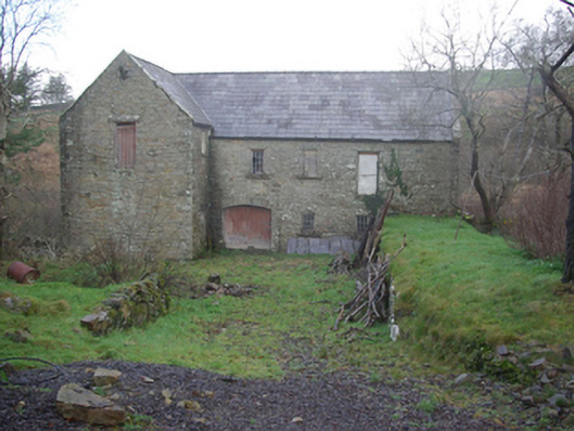 Muileann Arbhair Leitirmill (water) · 1692 yd
 Shalwy Court Tomb / Muinner CarnCourt tomb · 1706 yd
 CroaghmuckrosMountain / peak · 1.7 mi
 TrabaneBeach / strand · 2.0 mi
 TraloarBeach / strand · 2.0 mi
 CrownaradMountain / peak · 2.3 mi
 Dundawoona Point / Pointe an DúinHeadland · 3.1 mi
 Cliffs at TeelinPublicly named cliff or headland · 3.3 mi
 Bawn in KillybegsBawn · 4.4 mi
 Cat CastleCastle, tower house · 4.4 mi
Other information
Photo: Credit not shown in the picture search · Rights wording not checked; contact us if this picture should be removed