
What is recorded here
Castle, ringwork in Williamstown (briscoe),williamstown (rochford) stands on a prominent hillock with commanding views in all directions. Its raised circular platform measures about 35m across at the base and 19m across at the top, with a dished interior and a shallow fosse around the hill’s foot. The exact meaning of the mound remains uncertain, but it may preserve a platform ringfort or an Anglo-Norman ringwork beside the medieval parish church of Killulagh.
Situated on a prominent hillock, with commanding views in all directions. Medieval parish church of Killulagh (WM013-057---) which may have been built on an early Christian monastery founded by St. Lonán lies 325m to NE. Mound barrow (WM013-056----) 155m to NNW. A steam which forms the townland boundary lies 40m to the W and NW, and the field fence which forms the townland boundary with Williamstown intersects the E side of the site.
A raised circular shaped platform (approx. diam. 35m NE-SW at base; 19m NE-SW at top) with dished interior defined by an earth and stone bank, the base of the hill is enclosed by a shallow fosse with external earth and stone bank. The top of the platform/mound has a dished profile (approx. diam. 15m NE-SW) and is enclosed by a very poorly preserved earth and stone bank. There is a gap (Wth 1.9m) in the bank at NNE and a narrow path down the side of the embankment, possible livestock gap of recent origin. Classification of moument is uncertain, could be the remains of a platform ringfort or Anglo-Norman ringwork.
See attached profile of monument surveyed and drawn by the ASI.
Compiled by: Frank Coyne and Caimin O'Brien
Date of upload: 10 April 2018
A ringwork castle in Williamstown, possibly built in the 12th or 13th century, likely by a local Norman or Anglo-Norman lord for defensive purposes. Its location on a prominent hillock and proximity to a medieval church suggest it was a strategic and religiously significant site in the region.
The monument record does not grant public access. Check the route and ask the landowner before entering private land.
- What survives
- Recorded monument
Places near here
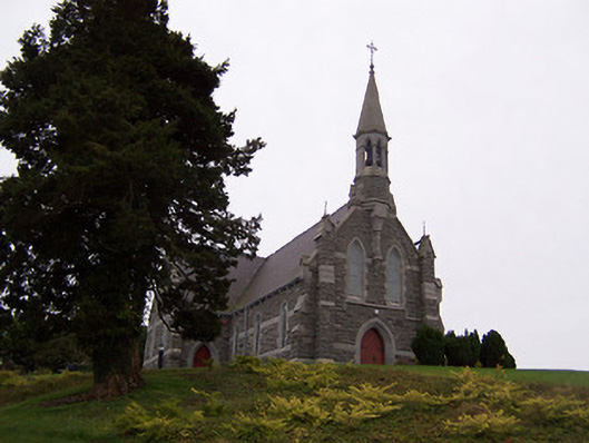 Saint Livinius's Catholic Churchchurch/chapel · 321 yd
 Font in Killulagh,williamstown (rochford)Font · 328 yd
 Church in ruinsChurch · 411 yd
 Ecclesiastical enclosure in KillulaghEcclesiastical enclosure · 414 yd
 Bawn in Williamstown (briscoe)Bawn · 646 yd
 Castle in ruinsCastle, unclassified · 686 yd
 GinkgoGinkgo · 1.1 mi
 The FurzeForest · 4.5 mi
 Castle IslandIslet · 5.9 mi
 Kells HillMountain / peak · 7.2 mi
 Seafin HillMountain / peak · 7.8 mi
 Croppies' GraveMemorial · 12 mi
Other information
Photo: Credit not shown in the picture search · Rights wording not checked; contact us if this picture should be removed