
What is recorded here
In flat pastureland c. 130m to the SW of Castle Ellen House, a 19th-century county house. Named ‘Castle (in ruins)’ on the 1838 edition of the OS 6-inch map and depicted as a roughly square building occupying the SE angle of a large roughly subrectangular, internally divided, area depicted by a pecked line, which Cody (1989, 352-3) suggests indicates the outline of an associated bawn (see GA084-050002-). Only the SW half of the tower house survives: the SW wall (L 6.1m; wall T 1.2m) and the returns of the SE (L 3.1m) and NW walls (L 3.1m); a short length of modern walling (L 1m) extends off the NW wall. It stands to a height of four storeys and has a base-batter. A section of the bawn wall adjoins the SW wall, roughly at its mid-point. The external wall-face is pebble dashed but some ashlar quoinstones are visible. The upper half of the tower is heavily overgrown with ivy. Internally the walls are plastered. All the floors have collapsed. A fireplace is visible in the SW wall on the ground floor. A projecting corbel on its S side bears the letters MB and underneath the numbers 16. Cody’s (ibid., 354-5) research suggests that this is one of a pair of inscribed corbels that bore the date 1672 or 1691; the second corbel is missing. Another fireplace and chimney is visible on the 1st floor. A rectangular doorway to its N and a similar doorway on the 2nd floor accessed rooms over the vaulted gateway of the bawn. Due to the ivy growth no architectural features were evident on the 3rd floor. Two breaches occur in this wall, one at ground level where there was formerly a lintelled doorway and the other on the 1st floor near its S end. Apart from possible traces of an arrow loop or single-light window in the SE wall (SMR file), no other features were noted and likewise in the NW wall. The tower house and bawn now stand isolated in a modern rectangular enclosure/folly (GA084-050002-).
Compiled by: Olive Alcock
Date of upload: 3 September 2021
Built in the 13th or 14th century, likely by a local Norman or Anglo-Irish lord, Castle Ellen is remembered as a medieval stronghold that reflects the pattern of early colonial settlement in Ireland. Its ruins and historical presence contribute to the understanding of regional power structures during the medieval period.
The monument record does not grant public access. Check the route and ask the landowner before entering private land.
- What survives
- Recorded monument
Places near here
 Country house in Castle EllenCountry house · 163 yd
 Enclosure in Castle EllenEnclosure · 255 yd
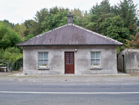 Castle Ellen Housegate lodge · 543 yd
 Belleville CastleCastle · 1658 yd
 Convent (in ruins)Castle, ringwork · 1704 yd
 Field system in Carnaun (athenry By.)Field system · 1715 yd
 First Battle of Athenrybattle · 1.9 mi
 The HazelWood · 2.0 mi
 Horse-chestnutHorse-chestnut · 2.4 mi
 Athenry CastleHeritage attraction · 2.7 mi
 Athenry AbbeyHeritage attraction · 2.8 mi
 Leadmine HillMountain / peak · 11 mi
Other information
Photo: Credit not shown in the picture search · Rights wording not checked; contact us if this picture should be removed