What is recorded here
Colhoun (1949) listed this site as a 'multi-chambered cairn or dolmen'. The feature is a grass-grown mound c. 15m in diameter and 3.5m high, which seems to be partly natural (Lacy 1983).
OS Revision Name Book, sheet 11 (1848), 105; Colhoun 1949, 116; Killanin and Duignan 1962, 127; Killanin and Duignan 1967, 140; Bonner 1972, 16; SMR 1987, 11:21; Colhoun 1995, 31, no. 11/6; RMP 1995, 11:21.
A mound of stones c. 15m in diameter and 3.5m high which seems to be partly natural. It is situated in pasture with low rock outcrops abounding.
The above description was published in the 'Survey of the Megalithic Tombs of Ireland. Volume VI, County Donegal.' Compiled by: Eamon Cody (Dublin: Stationery Office, 2002).
Date of upload: 22 September 2008
Multi-chambered cairn, likely dating to the Neolithic or early Bronze Age. Its structure suggests ritual or funerary use, though its exact significance remains unclear due to limited documentation.
The monument record does not grant public access. Check the route and ask the landowner before entering private land.
- What survives
- Recorded monument
Places near here
 Drumaville Fairy FortFairy fort / earthen ringfort · 1531 yd
 Cross in TemplemoyleCross · 1.1 mi
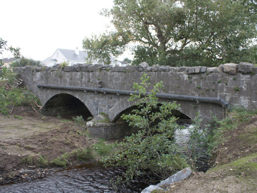 Strawbridge Bridgebridge · 1.2 mi
 Brachán Househouse · 1.2 mi
 Carndonagh Early Church GraveyardGraveyard · 2.6 mi
 CuldaffOfficial bathing water · 3.2 mi
 CastleCastle, unclassified · 3.3 mi
 Dough Famine VillageHeritage attraction · 5.3 mi
 Doagh Famine VillageMuseum · 5.3 mi
 Lag GraveyardGraveyard · 5.5 mi
 Five Finger StrandBeach / strand · 5.7 mi
 CrockavishaneMountain / peak · 6.4 mi