What is recorded here
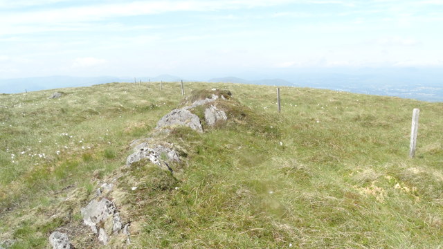
Once a neat three-metre circle, the cairn has collapsed into a long oval bruise on the rocky ridge. Loose stones and hidden kerbing still mark the shape beneath the heather, waiting for someone to read the change.
In rough heather-covered hill pasture, on a rocky ridge and within a field system (KE102-074001-). An oval cairn (10m NE-SW; 3.6m NW-SE; H 0.6m) of loose stones in a jumbled state. Remains of kerbing visible in the rubble suggests that the cairn was originally circular and had a diameter of c. 3m.
The above description is derived from the published 'Archaeological Inventory of County Kerry. Volume I: South-West Kerry' (Dublin: Stationery Office, 2009). In certain instances the entries have been revised and updated in the light of recent research.
Date of upload: 30 May 2011
The monument record does not grant public access. Check the route and ask the landowner before entering private land.
- What survives
- Recorded monument
Places near here
 Hut site in CrinagortHut site · 58 yd
 IndicatedEnclosure · 358 yd
 Bullaun StoneHeritage attraction · 778 yd
 Famine RuinRuins · 783 yd
 Bonane Heritage ParkMuseum · 1007 yd
 Glashagarriv Br.Bridge · 1149 yd
 BeneenMountain / peak · 1.4 mi
 KnocknamanaghMountain / peak · 1.6 mi
 The Priests LeapViewpoint · 3.1 mi
 CaoinkeenCliff · 3.1 mi
 CastleCastle, unclassified · 3.8 mi
 Monterey PineMonterey Pine · 4.4 mi