What is recorded here
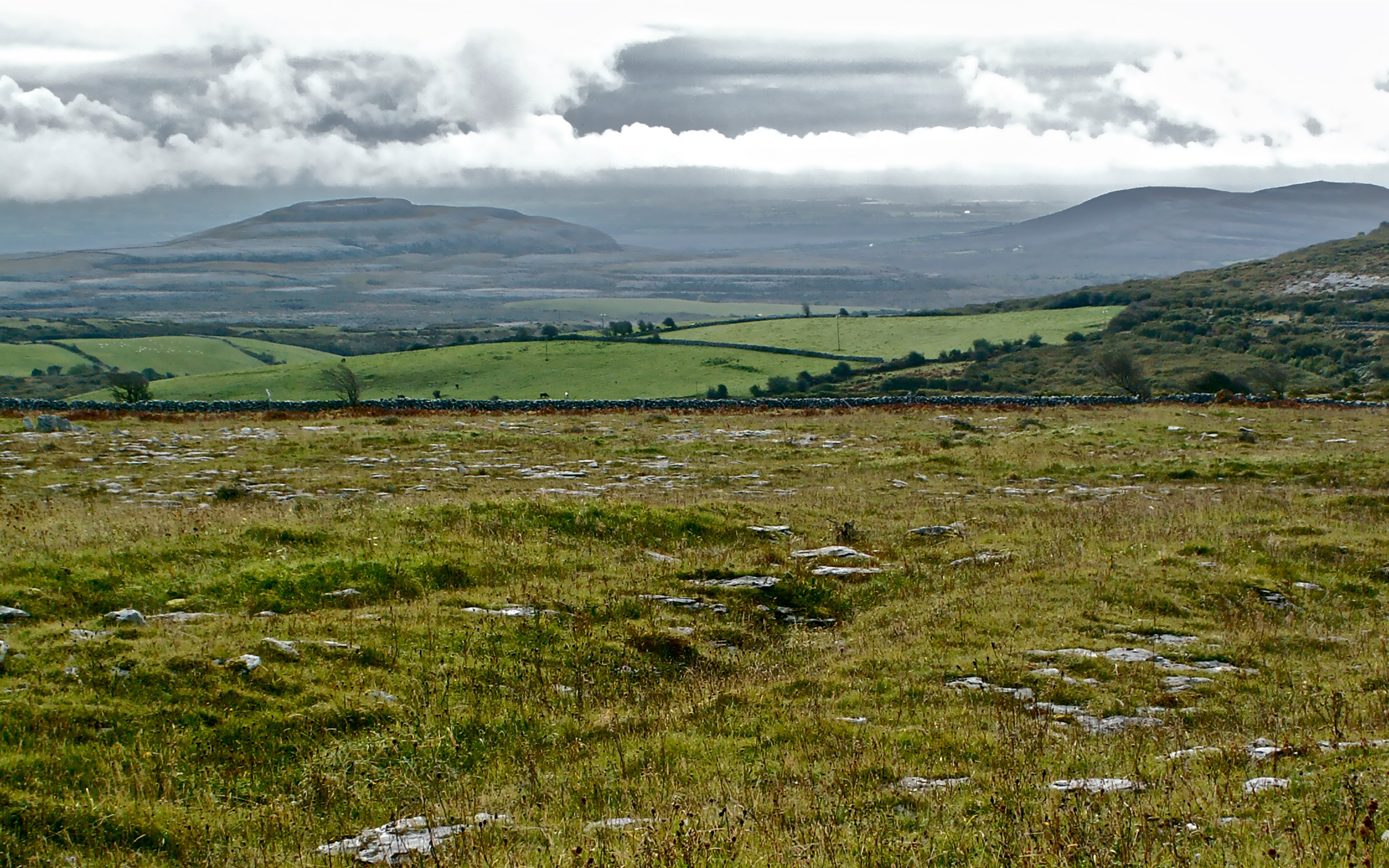
Carran, meaning the cairn, is a small Clare village set in rocky Burren pasture where Saint Columb may have prayed beside a clear spring and young Michael Cusack first imagined games for Irish people. Its limestone hills hold old forts, a disappearing lake and the shadow of copper mines, while a hundred and six neighbours still keep Cassidy’s, the schoolhouse and the parish road alive. The place does not need grandeur; it gives back clarity, excitement and belonging to anyone who leaves the main road and walks into its thin sharp air.
At the top of an E-W ridge in rough pasture and within an extensive field system (CL017-180----). A small oval cairn (c. 8m E-W; c. 7m N-S) is visible on OSi MapGenie 2012-2018 and was included as a cairn on a map by Jones, Carey and Hennigar (2011, 38). An unclassified megalithic tomb (CL010-089----) lies c. 75m to the NNE.
Compiled by: Mary Tunney
Date of upload: 15 May 2023
The monument record does not grant public access. Check the route and ask the landowner before entering private land.
- What survives
- Recorded monument
Places near here
 IndicatedFairy fort / stone ringfort · 364 yd
 Enclosure in CaherfaddaEnclosure · 413 yd
 Templeline (in ruins)Church · 1463 yd
 Farbrega RockNamed rock · 1.3 mi
 Fergus River CaveCave · 1.6 mi
 Leamaneh CastleCastle · 1.7 mi
 Leamaneh Castle (in ruins)House, fortified house · 1.7 mi
 Saint Joseph's Catholic Churchchurch/chapel · 2.0 mi
 Inchiquin IslandIslet · 3.2 mi
 Rock IslandIsland · 3.2 mi
 CaherconnellHeritage attraction · 3.4 mi
 Cave of the Wild HorsesCave · 3.7 mi