What is recorded here
Boy Hill in Ballycollin holds a cairn and cist where people reused a capstone as a standing stone. That choice suggests the hill was not forgotten but remade, perhaps marking a boundary, a burial or a warning to travellers. The stones still stand because human hands kept returning them to sight.
The official Northern Ireland record identifies this as CAIRN & CIST, with capstone reused as STANDING STONE: BOY HILL. Recorded period: PREHISTORIC. The official map point was placed at the centre of the recorded archaeological site from the source map reference.
Neolithic cairn and cist, possibly dating to the 4th–3rd millennium BCE, with a reused capstone as a standing stone. This site reflects early funerary and ritual practices in the region, showcasing the reuse of megalithic materials over time.
The monument record does not grant public access. Check the route and ask the landowner before entering private land.
- What survives
- Recorded monument
Places near here
 CollinMountain / peak · 571 yd
 ENCLOSURE (O.S. memoir site, unlocated) in BallycollinENCLOSURE (O.S. memoir site, unlocated) · 803 yd
 Slievenacloy Nature ReserveNature reserve · 1269 yd
 ENCLOSURE in LagmoreENCLOSURE · 1.3 mi
,_Derriaghy_(1)_-_geograph.org.uk_-_2990104.jpg?width=1280) Christ Church of IrelandChurch · 1.9 mi
Christ Church of IrelandChurch · 1.9 mi_Presbyterian_church_(2013)_-_geograph.org.uk_-_3559433.jpg?width=1280) First Presbyterian Church (Non Subscribing)Church · 2.3 mi
First Presbyterian Church (Non Subscribing)Church · 2.3 mi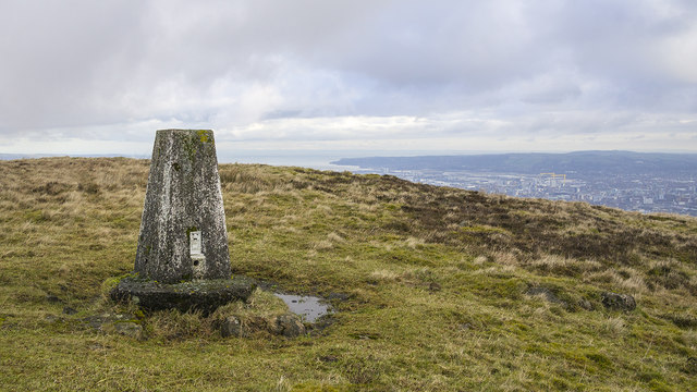 Black HillMountain / peak · 2.4 mi
 Belshaw's Quarry Nature ReserveNature reserve · 2.7 mi
 Battle at Springmartinbattle · 3.5 mi
 Lisburn War MemorialMemorial · 3.8 mi
 CASTLE later ARTILLERY FORT (site of) & GATE: LISBURN CASTLE, CASTLE GARDENS, LISNAGARVEY in LisburnCASTLE later ARTILLERY FORT (site of) & GATE: LISBURN CASTLE, CASTLE GARDENS, LISNAGARVEY · 3.8 mi
 The Wallace MemorialMemorial · 3.8 mi