
What is recorded here
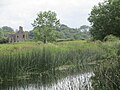
In the base of a valley running E-W in mountainous area. Circular round topped mound (H 3m; diam 19.2m) of earthen material with no evidence of an enclosing fosse or external bank.
The above description is derived from the published 'Archaeological Inventory of County Offaly' (Dublin: Stationery Office, 1997). In certain instances the entries have been revised and updated in the light of recent research.
Date of upload: 23 May 2011
The monument record does not grant public access. Check the route and ask the landowner before entering private land.
- What survives
- Recorded monument
Places near here
 Kinnitty ForestForest · 323 yd
 Holy well in Cumber UpperHoly well · 676 yd
 Broom HillMountain / peak · 792 yd
 Hilltop enclosure in Cumber Lower,cumber Upper,forelacka,lismoneyHilltop enclosure · 888 yd
 KnocknamanMountain / peak · 890 yd
 Kinnitty Castle LoopWalking route · 1.5 mi
 Partially indicatedRoad, road/trackway · 1.5 mi
 Castle (Site of)Castle, unclassified · 1.6 mi
 OutlinedCastle, motte · 1.6 mi
 Slieve Bloom Mountain Bike TrailVisitor information · 1.6 mi
 Waypoint 1Visitor information · 1.7 mi
 Church in Castletown AND GlinskChurch · 1.7 mi
Other information
Photo: Credit not shown in the picture search · Rights wording not checked; contact us if this picture should be removed