
What is recorded here
Castlefleming Stubber stands on a high ridge in County Laois, its rectangular walls and broken south tower still marking the edge of the sky. The Down Survey mapped it in 1655, yet local people later admitted they knew nothing of its history. That gap is not an absence; it is an invitation to imagine the hands that built it, the families that lived inside it and the reasons they stopped coming home.
Situated on an elevated site in undulating countryside. A rectangular hall-like structure (LA027-016), now two storeys high and with the remains of a south projecting tower in the SW angle and a later extension off the NW angle. There is a possible bawn wall attached to the E end. Castle marked on the Down Survey (1655-6) map and 'supposed to be the ruins of a fortress' (O'Flanagan, 1933, 91).
Described in the OS letters as 'There are old walls in the Townland of Garrison which area supposed to be the ruins of a fortress, but the peopl know nothing of its history' (O'Flanagan, 1933, vol. 1, p. 36).
Compiled by: Caimin O'Brien
Date of upload: 17 December 2007
The monument record does not grant public access. Check the route and ask the landowner before entering private land.
- What survives
- Recorded monument
Places near here
 CastleCastle, unclassified · 373 yd
 St. Kierans Monastery (Site of)Religious house, unclassified · 1608 yd
 Church (in ruins)Church · 1749 yd
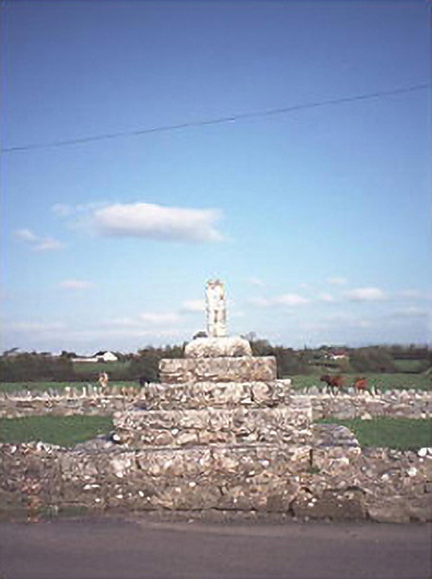 Errill Crosscross · 1.1 mi
 Burial Ground (Disused)Church · 1.4 mi
 Ballagh CastleCastle · 1.9 mi
 Clonmeen WoodWood · 3.0 mi
 Carricknasrock WoodWood · 3.6 mi
 Black HillMountain / peak · 3.7 mi
 Tullow HillMountain / peak · 5.0 mi
 Cnoc SeanrathaMemorial · 5.8 mi
 DelaneyMemorial · 9.5 mi
Other information
Photo: Credit not shown in the picture search · Rights wording not checked; contact us if this picture should be removed