What is recorded here
Barrow is an unclassified circular enclosure, twenty-five metres across, hidden in reclaimed pasture near Ballyneety House. It sits aligned with two other monuments on a northwest-southeast axis, suggesting deliberate placement rather than chance. The earth may have swallowed human life, ritual or memory before pasture covered it, yet the shape still resists forgetting.
In reclaimed pasture 100m W of watercourse and 260m S of Ballyneety House. One of three monuments aligned on a NW-SE axis. Enclosure (LI033-039002-) to immediate NE and ringfort (LI033-039001-) 50m to NE. Not depicted on OSi historic maps. Identified by Bruff aerial photographic survey in 1986 (Bruff 98; AP 4/3618) as an enclosure. Visible as a raised circular-shaped area (diam. c. 25m) enclosed by a fosse, truncated at N by a field boundary running NE-SW on OSi orthophoto taken between 2005-12 and on Google Earth orthoimage dated 28/06/2018.
See attached Google Earth orthoimage and Bruff image
Compiled by: Martin Fitzpatrick
Date of upload: 13 April 2021
The monument record does not grant public access. Check the route and ask the landowner before entering private land.
- What survives
- Recorded monument
Places near here
 Enclosure in Ballyneety SouthEnclosure · 40 yd
 BarrowBarrow, ditch barrow · 141 yd
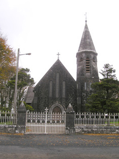 Saint Brigid's Catholic Churchchurch/chapel · 524 yd
 Site of Ballyneety CastleCastle, unclassified · 608 yd
 Templebredon Church (in ruins)Church · 959 yd
 RathardCastle, ringwork · 1671 yd
 St. Patrick's WellSpring · 3.2 mi
 Kilteely HillMountain / peak · 3.2 mi
 Oola HillMountain / peak · 3.4 mi
 Flat cemetery in Knockainy WestFlat cemetery · 6.1 mi
 St Patrick's WellSpring · 6.6 mi
 Ballinvreena LoopVisitor information · 9.6 mi