What is recorded here
In undulating pastureland with a sea-cliff c. 70m to the W, and higher ground to the E. Hachured on both the OS 25-inch plan (1897) and the later, Cassini edition (1920) of the OS 6-inch map. This well-preserved, circular ring-barrow (23.2m E-W; 23m N-S) comprises a flat-topped, steep-sided, central mound (basal diams. 9.5m N-S; 9.1m E-W; surface diams. 3.6m N-S; 3m E-W; H over fosse 1.3-1.55m; H over exterior surface 0.2-0.3m) with a slight central depression, enclosed by a flat-bottomed, steep-sided fosse (av. basal Wth 2.2m) and a steep-sided, outer bank (Wth 4.2-4.6m; int. H 0.55-1.65mm; ext. H 0.2-0.45m) which is generally round-topped except for a short section at E where it is flat-topped (Wth 1.3m). Some stones are visible in the bank's make-up. There is a narrow livestock gap (Wth 1m) in the bank at NNE and a later field bank (nearly levelled) is built right against its outer face at N. There are two other ring-barrows nearby, one (CL008-085001-) c. 100m to the SSW and another (CL008-085002-) c. 93m to the S.
See attachments:
• CL008-086----_01.jpg Aerial view of monument from south. (Marcus Casey)
• CL008-086----_02.jpg Ground view of monument from south south-west.
Summary by: Gearóid Conroy and Conn Herriott
Date of upload: 24 November 2022
Circular Neolithic or Bronze Age ring-barrow; its location suggests a ceremonial or funerary significance within a landscape of natural and man-made features.
The monument record does not grant public access. Check the route and ask the landowner before entering private land.
- What survives
- Recorded monument
Places near here
 Enclosure in DoonnagoreEnclosure · 421 yd
 Doonagore Castle in ruinsCastle, tower house · 525 yd
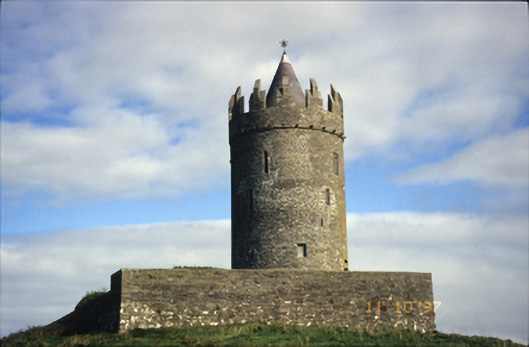 Doonnagore Castlecastle/fortified house · 525 yd
 bridgebridge · 797 yd
 CaherEnclosure · 904 yd
 Doonmacfelim Castle (in Ruins)Castle, tower house · 1044 yd
 Fisherstreet PotCave · 1260 yd
 Doolin FerriesHeritage attraction · 1343 yd
 Wild Atlantic Way: Doolin PierVisitor information · 1357 yd
 Ballaghaline PointHeadland · 1494 yd
 Doolin PointHeadland · 1.1 mi
 Crab IslandIslet · 1.1 mi