What is recorded here
In undulating pasture c. 130m E of sea cliffs, with higher ground E-SSE. Hachured on the 1897 OS 25-inch plan and 1920 ed. of the OS 6-inch map. This circular ring-barrow (ext. diams. 21m E-W; 20.3m N-S) comprises a steep-sided, flat-topped central mound (basal diam. c. 9m; surface diam. c. 6.8m; H over fosse 0.8-1.25m; H over external ground surface 0.25m) which has been dug into along the S, and is surrounded by a flat-bottomed fosse (Wth 1.8-2.3m) and a broad, steep-sided, almost flat-topped outer bank (Wth 3.7-5m; int. H 0.75-1.25m; ext. H 0.25-0.9m). There are two other ring-barrows nearby, one (CL008-085002-) c. 12m to the E and another (CL008-086----) c. 100m to the NNE.
See attachment: CL008-085001-_01 Monument viewed from W.
Summary by: Gearóid Conroy and Conn Herriott
Date of upload: 7 December 2022
A ring-barrow, likely dating to the Early Bronze Age, and representing a significant type of funerary monument associated with burial practices in Atlantic Europe. Its survival in a coastal setting highlights the importance of such sites in prehistoric landscapes.
The monument record does not grant public access. Check the route and ask the landowner before entering private land.
- What survives
- Recorded monument
Places near here
 Doonagore Castle in ruinsCastle, tower house · 442 yd
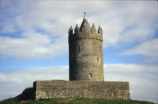 Doonnagore Castlecastle/fortified house · 443 yd
 Enclosure in DoonnagoreEnclosure · 513 yd
 CaherEnclosure · 862 yd
 bridgebridge · 926 yd
 Doonmacfelim Castle (in Ruins)Castle, tower house · 1177 yd
 Fisherstreet PotCave · 1378 yd
 Doolin FerriesHeritage attraction · 1426 yd
 Wild Atlantic Way: Doolin PierVisitor information · 1440 yd
 Ballaghaline PointHeadland · 1556 yd
 Crab IslandIslet · 1.1 mi
 Doolin PointHeadland · 1.1 mi