What is recorded here
In County Kerry, a sub-circular bank stands twenty-two metres wide, its dished centre holding rainwater like a forgotten cup. The earth rises barely seventy centimetres internally, yet that small ridge has survived long enough to suggest a deliberate boundary rather than a random mound. A gap appears on the north-west side, perhaps an entrance or perhaps merely animal traffic wearing the bank flat. People may have gathered there to mark seasons, exclude herds, or simply enjoy the shallow water collecting in the middle.
'The site consists of a sub-circular enclosure measuring 21.5m N-S and 22m E-W with a dished profile and no trace of an internal or external ditch. The enclosing bank varies in width between 5.6m - 7.8m and is on average 0.4m high externally and 0.7m high internally. There is a possible 6m wide gap to the north-west which may be an original entrance but could equally be the result of flattening of the bank by animals.'
Description from ‘The Prehistoric Settlement of the Lee Valley, Tralee, Co. Kerry; A Landscape Perspective’ by Michael Connolly. PhD Thesis UCC 2008
Date of upload: 22 June 2012
The monument record does not grant public access. Check the route and ask the landowner before entering private land.
- What survives
- Recorded monument
Places near here
 Enclosure in Gortbrack EastEnclosure · 1431 yd
 Enclosure in BallycartyEnclosure · 1.1 mi
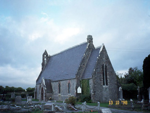 Ballyseedy Churchchurch/chapel · 1.2 mi
 Ballyseedy Church (in ruins)Church · 1.3 mi
 Monument WoodWood · 1.3 mi
 IndicatedCastle, unclassified · 1.4 mi
 Common AlderCommon Alder · 1.4 mi
 Bealagrellagh CastleCastle · 1.5 mi
 Scotia's GraveArchaeological place · 2.4 mi
 Civil War MemorialMemorial · 2.8 mi
 PoulatouirtCave · 2.8 mi
 Knockmichael MountainMountain / peak · 2.9 mi