What is recorded here
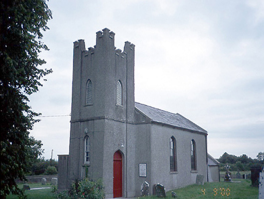
On a broad ridge in County Meath, a grass-covered barrow rises three metres at its southern edge, watching Broad Meadow Water from a distance of two hundred and fifty metres. People dug a trench across it around 1920 and found only a pavement, leaving a sunken line that still marks the mound today. The church at Greenoge stands seventy metres to the northeast, close enough to suggest the barrow belonged to the same living landscape rather than a forgotten myth.
Located on a broad WNW-ESE ridge with the WNW-ESE Broad Meadow Water c. 250m to the N, while the parish church of Greenoge (ME045-018----) is c. 70m to the NE. This is a grass-covered circular earthen mound (diam. of base 17.5m N-S; 16m WNW-ESE; H 2.1m at N to 3.5m at S) with a slight berm around the base at S. A trench has been dug across the mound E-W which is now a slightly sunken grass-covered feature (Wth 2m). Locally, this is thought to have happened c. 1920 when nothing was found except what is described as a pavement (SMR file). (Feeley 2001, 49-5, No. 40)
The above description is derived from the published 'Archaeological Inventory of County Meath' (Dublin: Stationery Office, 1987). In certain instances the entries have been revised and updated in the light of recent research.
Compiled by: Michael Moore
Date of upload: 10 July 2007
Amended: 17 December 2021
Mound barrow, likely dating to the Early Bronze Age. It represents a type of funerary monument associated with burial and ceremonial practices of the period.
The monument record does not grant public access. Check the route and ask the landowner before entering private land.
- What survives
- Recorded monument
Places near here
 Church (in Ruins)Church · 91 yd
 Enclosure in BallaghawearyEnclosure · 527 yd
 Enclosure in Rath (ratoath By., Greenoge Par.)Enclosure · 1041 yd
 CastleCastle, motte · 1.1 mi
 Wooly Ward's FarmHeritage attraction · 1.3 mi
 Saint David's Church (Kilsallaghan)church/chapel · 1.5 mi
 AshbourneMemorial · 1.5 mi
 Graveyard in KillosseryGraveyard · 1.9 mi
 Freedagh MoatCastle, motte · 2.3 mi
 Wesley's WoodsWood · 3.6 mi
 St. John's WellSpring · 4.0 mi
 St Cronans WellSpring · 4.6 mi