
What is recorded here
In reclaimed pasture on the summit of a ridge (OD 680ft.) known locally as ‘Oileán na crú’. Possible pond barrow (LI033-020----) 70m to SW and ringfort (LI033-023----) 45m to W. Depicted on OSi 25-inch map as a raised circular-shaped area (diam. 15m) with a trigonometric station in N quadrant. Surveyed by the ASI in 2007 and described as a circular-shaped area (diam. 15m) enclosed by an earth and stone bank (Wth 4.65m; int. H 0.25m; ext. H 0.65m), with fosse (Wth 3m; D 0.2m) and outer bank (Wth 1m; int. H 0.7m; ext. H 0.5m) visible from NW-S and WSW-WNW. Gaps in outer bank (Wth 5m) at NNW and (Wth 4.5m) at SSW with causewayed entrance (Wth 1.7m) at ENE. A rectangular-shaped depression in the interior may indicate the location of the former trigonometric station. Truncated at W by a linear field bank running NNW-SSE. Described in 1960 as follows; ‘Interior 36 feet (11m) in diameter. A 5 foot (1.5m) wide ditch is encircled by an outer bank 9 feet (2.7m). On east side there is a gap which may denote an entrance. Interior of this earthwork is lower than field outside (O’Dwyer 1958-61, 115; Knockroe 54). Monument is clearly visible on OSi orthophoto taken between 2005-12 and on Google Earth orthoimage dated 20/09/2020.
See attached Google Earth orthoimages
Compiled by: Martin Fitzpatrick
Date of upload: 30 March 2021
See attached ASI aerial photograph ASIAP - 133/03, 04 taken 23/08/2000 and 353/7 taken 05/01/2003.
Embanked barrow, likely dating to the Early Bronze Age. Its location on a prominent ridge suggests ritual or funerary significance, possibly linked to adjacent monuments such as the possible pond barrow and ringfort.
The monument record does not grant public access. Check the route and ask the landowner before entering private land.
- What survives
- Recorded monument
Places near here
 BarrowBarrow, pond barrow · 113 yd
 Enclosure in Knockroe (coonagh By.)Enclosure · 382 yd
 Carrickittle RockCastle, unclassified · 1414 yd
 St. Patrick's WellSpring · 1603 yd
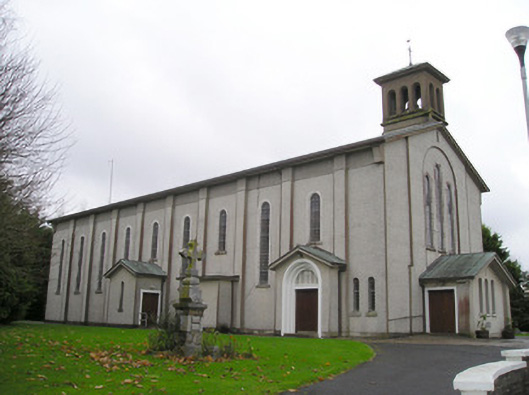 Catholic Church of Saint Patrick and Saint Brigidchurch/chapel · 1633 yd
 R.C. ChapelChurch · 1700 yd
 Kilteely HillMountain / peak · 1.2 mi
 (Site of) CastleCastle, unclassified · 1.6 mi
 KnockseefinMountain / peak · 2.4 mi
 Flat cemetery in Knockainy WestFlat cemetery · 5.0 mi
 St Patrick's WellSpring · 6.9 mi
 Ballinvreena LoopVisitor information · 9.8 mi
Other information
Photo: Credit not shown in the picture search · Rights wording not checked; contact us if this picture should be removed