What is recorded here
Situated in the SW part of the interior of the henge (ME019-016001-) and just NE of the hut site (ME019-016002-). Archaeological excavation (E000090) recorded a circular area (int. diam. 4.5m) defined by a continuous ditch (Wth of top 1-1.1m; Wth of base 0.5-0.6m; max. D 1m), the base of which was lined with cobbles. The cobbles had been removed at NE where there was a hearth, and a sherd of Beaker pottery was found at the base of the ditch. At the centre of the enclosed area a pit (diam. 0.5m; D 0.3m) had a fragile flat-based pot resting on a slab and one sherd of another finer ware but human remains did not survive. (Sweetman 1971, 139-40; 1976, 35-37)
Compiled by: Michael Moore
The above description is derived from the published 'Archaeological Inventory of County Meath' (Dublin: Stationery Office, 1987). In certain instances the entries have been revised and updated in the light of recent research.
Date of upload: 10 July 2007
Amended: 28 January 2021
Ditch barrow, dating to the Neolithic or early Bronze Age. Its location within a henge suggests ritual or ceremonial significance in a prehistoric landscape.
The monument record does not grant public access. Check the route and ask the landowner before entering private land.
- What survives
- Recorded monument
Places near here
 Enclosure in MonknewtownEnclosure · 374 yd
 Font (present location) in MonknewtownFont (present location) · 423 yd
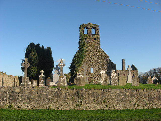 Church (in Ruins)Church · 492 yd
 mill (water)mill (water) · 579 yd
 Knowth Timber CircleHeritage attraction · 1.4 mi
 School WoodForest · 1.4 mi
 KnowthArchaeological place · 1.4 mi
 Quarry Garden WoodForest · 1.6 mi
 Dowth CastleCastle, tower house · 1.6 mi
 Proudfootstown CastleCastle, unclassified · 1.8 mi
 Brú na Bóinne Visitors CentreVisitor information · 2.1 mi
 Hurcle HillMountain / peak · 2.3 mi