What is recorded here
Ballycarroll Caher is a circular stone ringfort on a Clare ridge, its wall still standing two metres thick though grass and scrub have swallowed every entrance. The stones spread west and east like a broken collar, suggesting the fort did not collapse so much as dissolve back into the hill. It may have been a human home, a boundary marker, or a fortress built for someone who never needed a door.
Situated on the E edge of a NE-SW ridge with rock outcrop. Listed as 'Enclosure' in the SMR (1992) and the RMP (1996). A circular grass- and scrub-covered area (int. diam. 22m E-W) defined by an overgrown stone spread (at W: Wth 4m; int. H 1m; ext. H 1.6m; at E: Wth 12m; int. H 0.8m; ext. H 0.6m) with the original wall visible (Wth 2-2.4m; int. H 0.8-1.1m; ext. H 1.3-1.6m), especially S-W. There is no visible entrance.
Compiled by: Michael Moore
Date of upload: 3 May 2017
Ballycarroll Caher is a likely early-medieval ringfort, characterized by a circular, grass-covered enclosure with an internal diameter of about 22 meters, situated on a rocky ridge. Local tradition may associate such sites with fairy lore, though specific folklore for this site is not recorded.
The monument record does not grant public access. Check the route and ask the landowner before entering private land.
- What survives
- Recorded monument
Places near here
 IndicatedFairy fort / stone ringfort · 326 yd
 Gorteenflugh FortEnclosure · 478 yd
 CastleCastle, ringwork · 1040 yd
 Templehughoconnell (in Ruins)Church · 1200 yd
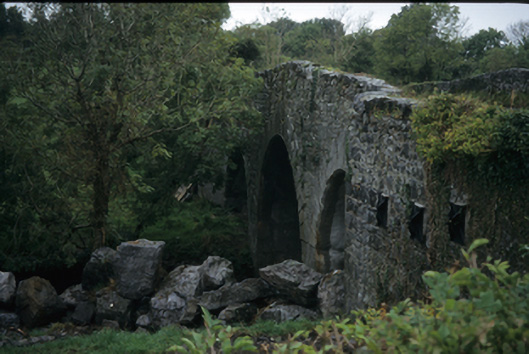 Nutfield Bridgebridge · 1597 yd
 Dromore WoodWood · 1.2 mi
 Dromore CastleCastle · 1.5 mi
 Ardcarney WoodWood · 1.5 mi
 Battle of TullyodeaBattlefield · 3.1 mi
 Mulkere MemorialMemorial · 3.5 mi
 Ennis AbbeyMuseum · 4.1 mi
 Clare MuseumMuseum · 4.3 mi
Other information
Photo: Credit not shown in the picture search · Rights wording not checked; contact us if this picture should be removed