
What is recorded here
Detached T-plan four-bay double-height former girls' national school, built in 1931, having gable-fronted two-bay projecting bay to front (north-east) and single-bay porch to rear (south-west). Now in use as a Montessori school. Pitched slate roof with rendered chimneystacks, eaves course and recent cast-iron styled aluminium rainwater goods. Lean-to corrugated-iron roof to rear porch. Rough-cast rendered walls with tooled limestone date plaque to front elevation of projecting bay. Ocular ventilation openings at plinth height. Square-headed window openings with tooled limestone sills and raised render surrounds throughout, having replacement six-over-nine pane timber sliding sash windows. Square-headed door opening with raised render surround to side (south-east) elevation of central gable-fronted projecting bay, having tooled limestone step and timber battened door. Later five-bay single-storey toilet block to south-west of school, having roughcast rendered wall linking toilet block to school. Roughcast rendered boundary walls to front having chamfered render coping, square-profile piers with chamfered render capping and double-leaf wrought-iron gates.
This well maintained attractive school building retains much of its historic form and character through the retention of key historic features such as a fine slate roof and sash windows. The building follows a typical early twentieth-century school design with a large central school room accessed through the front bay with a separate toilet block to the rear. The building makes a strong and positive contribution to the local architectural heritage. A rusticated cut-limestone plaque is inscribed: ""Scoil Náomh [sic] Íde/Át na Fuinnseóige/Scoil Náisiúnta/ASHFORD GIRLS' N.S./A.D. 1931"".
This does not grant access. Most recorded buildings are privately owned; view them only from public ground unless the owner allows entry.
Places near here
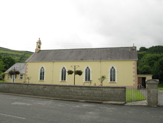 Saint Ita's Catholic Churchchurch/chapel · 211 yd
 post boxpost box · 235 yd
 Mass-rock in GortnaclohyMass-rock · 531 yd
 Ballagh MountainMountain / peak · 1369 yd
 Grave YardGraveyard · 1.4 mi
 Saint Ite's WellSpring · 1.4 mi
 Dotted outlineBawn · 1.5 mi
 Glenduff CastleCastle, tower house · 2.1 mi
 Mullaghareirk - Banane LoopWalking route · 3.5 mi
 Rock HillMountain / peak · 3.9 mi
 TobereenalaffinaSpring · 5.5 mi
 Limerick GreenwayWalking route · 7.3 mi
Other information
Photo: National Inventory of Architectural Heritage · Website use allowed for educational or private purposes with source credit