What is recorded here
Ancient Wall with Cave is a small oval hut site in County Clare, Ireland, built from large stones on a south-facing limestone slope. The wall stands barely higher than a kneeling person, enclosing a space where a stone-lined hollow sits beside the inner face. Maps call the hollow a cave, but its shape and depth suggest a well, inviting wonder about the water drawn or hidden there. The nearby cashel and field system imply the hut belonged to a lived landscape, not a forgotten ruin.
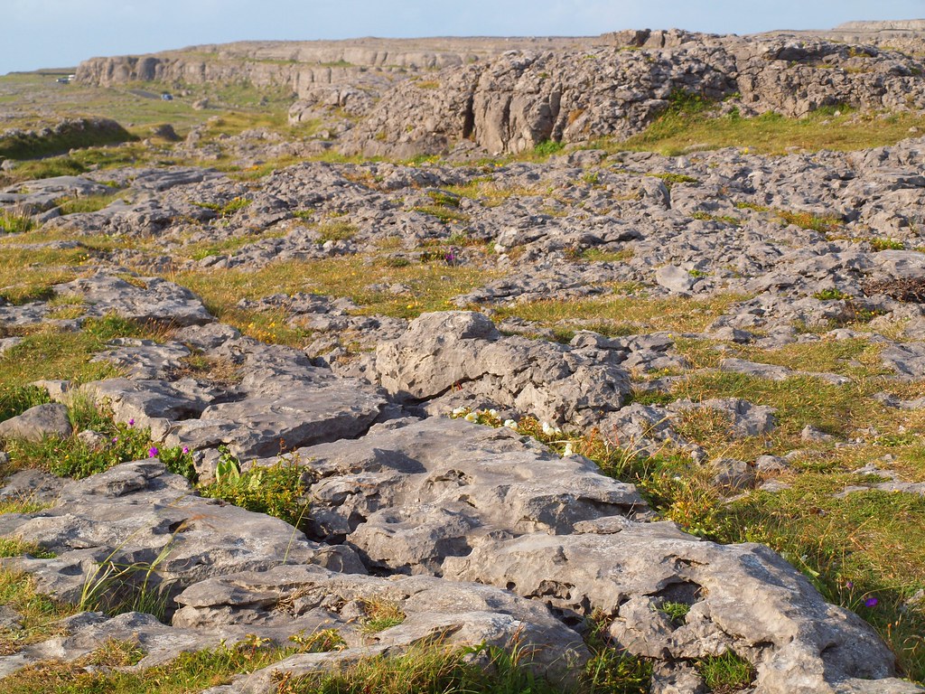
On a S-facing slope in rough pasture and limestone pavement, overlooked by higher ground immediately to the NE, and within a large multiperiod field system (CL009-059001-). Listed as 'Enclosure' in the RMP (1996). Indicated and named ‘Ancient wall with cave’ on the 1897 OS 25-inch plan and the 1920 ed. of the OS 6-inch map. Marked as a Man-made underground passage on Robinson’s map (1977). This small oval hut site (int. dims. 6.6m N-S; 6m E-W; ext. dims. 8.7m N-S; 9.15m E-W) is defined by a stone wall (Wth 1-1.5m; max. int. H 0.8m; ext. H c. 0.4m) with an inner face of large stones (max. L 1.2m; Wth 0.2m, max. H. 0.8m). There is a gap (Wth 2m) in the wall at SE, due to non-recent damage. A stone-lined hollow (L 1.1m; Wth 1.1m; max. D. 0.8m) with a stone in its base is in the E interior of the hut site, beside the wall. Although named 'Cave' on the OS maps this is more likely a well than a Man-made underground passage (contra Westropp 1897, 118). This hut-site was probably associated with Cahercutteen cashel (CL009-059039-), which lies c. 37m to NNE. The site of a cairn (CL009-059040-) lies c. 20m to the NE. An enclosure (CL009-059041-) lies c. 94m to the S and Caherwalsh (CL009-059045-) lies c. 160m to the SSE.
Compiled by: Mary Tunney and Conn Herriott
Date of upload: 8 February 2022
The monument record does not grant public access. Check the route and ask the landowner before entering private land.
- What survives
- Recorded monument
Places near here
 CahercutteenFairy fort / stone ringfort · 55 yd
 CaherwalshFairy fort / stone ringfort · 199 yd
 Noughaval Church (in ruins)Church · 522 yd
 Noughaval Crossmonument · 573 yd
 Site of Ballymurphy CastleCastle, tower house · 1.2 mi
 Ballyganner Castle (in ruins)Castle, tower house · 1.2 mi
 Cave of the Wild HorsesCave · 1.8 mi
 CaherconnellHeritage attraction · 2.3 mi
 High CrossHeritage attraction · 2.4 mi
 Burren Centre KilfenoraVisitor information · 2.4 mi
 Cullaun 5 (C5b)Cave · 3.1 mi
 Ballyteigue Nature ReserveNature reserve · 3.9 mi