What is recorded here
Marked only on the 1925 ed. of the OS 6-inch map where it is described in italic lettering as a windmill in ruins. It is 19th century in date and is situated at the top of a NW-facing slope. This is a tower of three storeys (ext. diam. of base 6.5m; int. diam. of base 4.3m; H c. 7.5m) with battered or sloping sides and traces of an external render. It has opposed lintelled doorways at E (Wth 0.97m; H 1.9m) and W (Wth 0.97m; H 1.86m) with granite surrounds. The first floor was supported on corbels at N and S and has rectangular windows with granite surrounds at N and S. The second floor was supported on corbels at N and S with a recessed ledge and has rectangular windows with granite surrounds at E and W.
The above description is derived from the published 'Archaeological Inventory of County Wexford' (Dublin: Stationery Office, 1996). In certain instances the entries have been revised and updated in the light of recent research.
Compiled by: Michael Moore
Date of upload/revision: 23 July 2013
The monument record does not grant public access. Check the route and ask the landowner before entering private land.
- What survives
- Recorded monument
Places near here
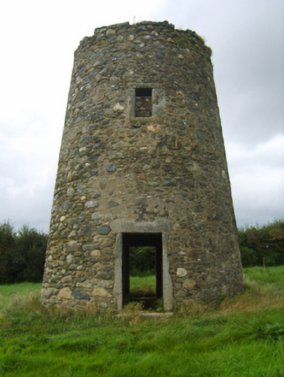 mill (wind)mill (wind) · 1 yd
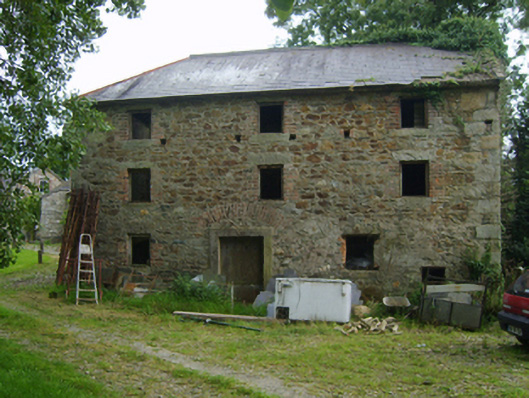 mill (water)mill (water) · 416 yd
 Font (present location) in DanescastleFont (present location) · 893 yd
 1798 MemorialMemorial · 1022 yd
 Carrig-On-BannowVisitor information · 1025 yd
 Danes Castle (in ruins)Castle, tower house · 1026 yd
 CrossesCross (present location) · 1042 yd
 CastleCastle, tower house · 1198 yd
 Blackhall StrandBeach / strand · 2.1 mi
 Cullenstown StrandBeach / strand · 2.1 mi
 Ballymadder PointHeadland · 2.2 mi
 Bridges ChamberCave · 2.2 mi