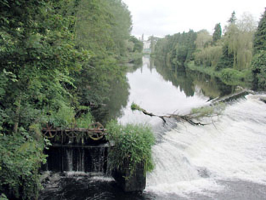
Overview
weir — Straffan is recorded as weir in Kildare. The saved date range is 1920 to 1940. Its recorded grade or rating is Regional. The saved evidence fixes the building and its protected record while keeping unknown builders, people and changes open.
Why it was built
The record classifies weir — Straffan as weir. It does not safely state the first owner's purpose beyond that use, so this first account does not borrow a story from a namesake.
People and work
No architect, builder, owner, worker or resident is named in the saved wording. Those people remain unknown until the linked official record or another source identifies them.
How it changed
The saved wording does not establish particular rebuilding, extensions, damage or changes of use. No visible feature is assigned a date without supporting evidence.
What survives
The public record still identifies the place as weir. Its saved point marks the building or centre of its recorded area, but the stock wording does not provide a room-by-room condition report.
Why it mattered
weir — Straffan matters for the exact reasons given in its official assessment, rather than merely because it is an old structure. The source records: This weir and associated sluice gate/hydraulic dam are of considerable technical interest, having been constructed to regulate the flow of the current of the River Liffey to accommodate a mill pond nearby. The structures are therefore also of some historical and social interest, attesting to the former presence of a small-scale industrial complex in the locality. Viewed from Straffan Bridge to the south-east the presence of the structures has a picturesque effect on the river. This explains what the place adds to local life, the street or the surviving built history.
History checked 15 August 2026 against the named sources below.
Add the human story, a picture, a first-hand message or a missing place.
Earn 5 points after the picture is checked and accepted.
Add a pictureAdd its storyTalk or ask a questionAdd a new placeThis official record and map point do not grant access. Most recorded buildings are privately owned; view them only from public ground unless the owner allows entry.
Conversation about this place
Questions and messages sit beneath the source record. They are checked before appearing.
No questions or messages yet.
Ask a question or join the conversation