What is recorded here
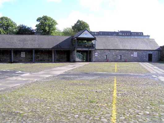
An irregular-shaped five-sided enclosed former market place, begun in 1843, with a river fronting multiple-bay two-storey rubble limestone faced building, extensively restored during the 1980s, with a covered loggia facing the confluence of the Abbey and Shannon Rivers. Pitched artificial slate roof to this building with steel column supports to loggia, rising from a carved stone coping on rubble limestone quay walls to Abbey River. Two gauged red brick elliptical arches to south; one forming a balcony with steel balustrade; the second opening onto the Sylvester O'Halloran Footbridge. To the north elevation this building appears to be a single-storey facing the cobbled market area, with a gable-fronted platform section. The market area is enclosed on the other sides by squared limestone ashlar wall supporting wrought-iron railings with cast-iron spear and axe-head finials. Massive limestone ashlar Greek Revival gate piers with tapering shafts having incised Greek key motif, and triangular capping stones with cat ear corners; supporting wrought-iron gates with spearhead finial and axe-head finial to slam bar.
William Henshaw Owen prepared plans and specifications for the erection of the potato market in 1843. A very impressive open market space with fine railings enclosing it from the public footpath approaching Mathew Bridge and along Merchant's Quay. The riverside appears to be mostly of recent origins and forms an attractive backdrop to the Abbey River at this point.
This does not grant access. Most recorded buildings are privately owned; view them only from public ground unless the owner allows entry.
Places near here
 Potato MarketMonument · 20 yd
 Merchants QuayQuay · 31 yd
 Mathew Bridgebridge · 73 yd
 Rutland Househouse · 76 yd
 Hunt MuseumMuseum · 102 yd
 OutlinedCastle, tower house · 196 yd
 Curragower FallsWaterfall · 204 yd
 Bourke HouseHeritage attraction · 222 yd
 Siege of Limericksiege · 227 yd
 Anthony Foley MemorialMemorial · 253 yd
 Graveyard in Limerick CityGraveyard · 289 yd
 Castle BarracksCastle, Anglo-Norman masonry castle · 330 yd
Other information
Photo: National Inventory of Architectural Heritage · Website use allowed for educational or private purposes with source credit