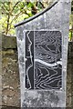
What is recorded here
This commemorative plaque records: The Contour Canal
The Contour Canal is an engineering marvel constructed in the 19th century to provide a waterway route across the Pennines, significantly reducing travel time between Liverpool and Manchester and boosting industrial trade.
A plaque record does not grant entry to a building or private land. View it from a public place unless permission is clearly given.
Places near here
 Union Canal, Ratho WestMilestone (period Unassigned) · 49 yd
 Edinburgh, Ratho Hall, Walled GardenWalled Garden (19th Century) · 51 yd
 Canal boat on the Union Canal at RathoHeritage place · 220 yd
 Platt Hill, treesMountain or hill · 327 yd
 South Platt HillCist(s) (period Unknown), Encampment (period Unknown), Human Remains (7th Century), Witch Association (post Medieval) · 420 yd
 Trig point, Platt HillMountain or hill · 430 yd
 Tower in Ratho QuarryCastle, fort or tower · 702 yd
 TormainMountain / peak · 1455 yd
 Bonnington Mains QuarryNo Class (event) (21st Century) · 1675 yd
 Glasgow RoadNo Class (event) (period Unassigned) · 1.1 mi
 Hatton HouseCountry House (17th Century), Tower House (medieval) · 1.3 mi
 603 'City of Edinburgh' Squadron Spitfire MemorialMemorial · 1.7 mi
Other information
Photo: Jim Barton on Geograph · CC BY-SA 2.0