What is recorded here
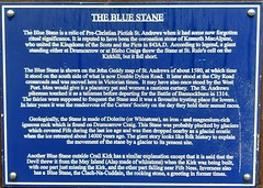
This blue commemorative plaque records: The Blue Stane is a relic of Pre-Christian Pictish St Andrews when it had some now forgotten ritual significance. It is reputed to have been the coronation stone of Kenneth MacAlpine, who united the Kingdoms of the Scots and the Picts in 843 A.D. According to legend, a giant standing either at Drumcarrow or at Blebo Craigs threw the Stane at St. Rule's cell on the Kirkhill, but it fell short. The Blue Stane is shown on the John Geddy map of St. Andrews of about 1580, at which time it stood on the south side of what is now Double Dykes Road. It later stood at the City Road crossroads and was moved here in Victorian times. It may have also once stood by the West Port. Men would give it a placatory pat and women a cautious curtsey. The St. Andrews pikeman touched it as a talisman before departing for the Battle of Bannockburn in 1314. The fairies were supposed to frequent the Stane and it was a favourite trysting place for lovers. In later years it was the rendezvous of the Carters' Society on the day they held their annual races. Geologically, the Stane is made of Dolerite (or Whinstone), an iron - and magnesium-rich igneous rock which is found on Drumcarrow Craig. This Stane was probably plucked by glaciers which covered Fife during the last ice age and was then dropped nearby as a glacial erratic when the ice retreated about 14000 years ago. The giant story looks like folk history to explain the movement of the stane by a glacier to its present site. Another Blue Stane outside Crail Kirk has a similar explanation except that it is said that the Devil threw it from the May Island (Also made of whinstone) when the Kirk was being built, with one part just missing the Kirk, and the other part falling near Fife Ness. Inverness also has a Blue Stane, the Clach-Na-Cuddain, the rocking stone, a greeting in former times.
The Blue Stane is an ancient Pictish relic that allegedly served as Kenneth MacAlpin's coronation stone when he united the Scots and Picts in 843 A.D., symbolizing early Scottish unification.
A plaque record does not grant entry to a building or private land. View it from a public place unless permission is clearly given.
Places near here
 St Andrews, Market Street, Hope Park Parish ChurchChurch (19th Century), War Memorial (20th Century) · 44 yd
 Victory Memorial HallMemorial · 60 yd
 St Andrews, Hope Street, GeneralGeneral View (period Unassigned) · 119 yd
 St Andrews, Alexandra PlaceNo Class (event) (period Unassigned) · 121 yd
 St Andrews, GreyfriarsHuman Remains (period Unassigned) · 180 yd
 St Andrews, City RoadCinerary Urn(s) (period Unassigned) · 184 yd
 St Andrews, South Street, Western SectionNo Class (event) (period Unassigned) · 201 yd
 General Sikorski MemorialMemorial · 236 yd
 St Andrews MuseumMuseum · 262 yd
 R&A World Golf MuseumMuseum · 468 yd
 Castle SandsBeach / strand · 870 yd
 West Sands BeachVisitor information · 917 yd
Other information
Photo: gnomonic · CC BY 2.0