
What is recorded here
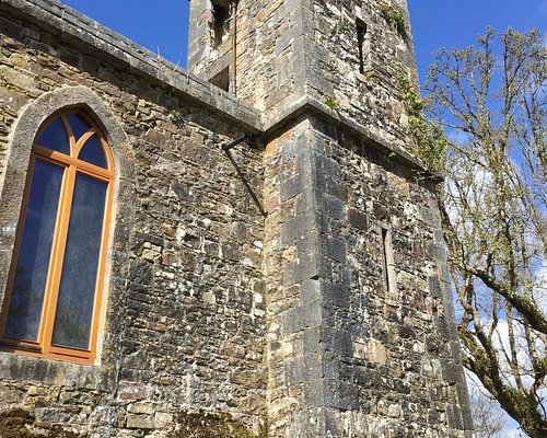
On a shelf at the bottom of a gentle SW-facing slope of a WNW-ESE ridge and c. 50m from a NW-SE stream. This is a rectangular structure (int. dims c. 11.5m E-W; 6.4m N-S) with ivy-covered walls (T 0.9m) obscured by rubble, but the E wall is missing. The N wall (H 0.5m), S wall (max. H 1.75m at W) and W wall (H 2.2m) are featureless. There is no enclosure, but there are a few plain grave markers of childrens' graves (RO026-016002-) in the interior. Toberwingan (RO026-016003-), a dry oval well (dims 2m x 1.5m; D 0.6m) enclosed by a drystone wall is c. 50m SW of the church. There was a whitethorn rag tree (RO026-016004-) at the well (Gannon 1972), and while the tree is present there are no offernings. Rath (RO026-015----) is c. 200m to the NNW.
Compiled by: Michael Moore
Date of upload: 24 August 2010
The monument record does not grant public access. Check the route and ask the landowner before entering private land.
- What survives
- Recorded monument
Places near here
 Ritual siteRitual site, holy tree/bush · 53 yd
 Lisgall FortFairy fort / earthen ringfort · 692 yd
 Coolougher WoodForest · 775 yd
 Quarry in ArmQuarry · 1.9 mi
 Church in Clooncoose SouthChurch · 2.1 mi
 Clonalis HouseMuseum · 2.3 mi
 Castlereagh HouseCastle, unclassified · 2.7 mi
 CastleCastle, unclassified · 2.8 mi
 Workhouse MemorialMemorial · 2.8 mi
 Silver IslandIslet · 3.4 mi
 Site of Killomaine Grave YardArchaeological place · 7.9 mi
 Slieve DartMountain / peak · 8.7 mi
Other information
Photo: Credit not shown in the picture search · Rights wording not checked; contact us if this picture should be removed