What is recorded here
Rathgeran holds a tall granite rib standing in bog water, its long edge pointing through a gap in the Blackstairs Mountains. The stone rises above rushes and gorse like a marker forgotten by the land, steady while the soil around it sags and breathes. Anyone who walks to it must wade through damp darkness, follow that thin line of rock, and imagine what human hands believed worth showing across the valley.
In low-lying very boggy terrain under rough pasture with rushes and gorse. The view is impeded by a hill immediately to the N, is dominated by the Blackstairs Mountains to the E and there is an extensive view to the S. The long axis of the standing stone points towards a gap in the Blackstairs Mountains to the SSE. A granite standing stone (H 1.3m) aligned NW-SE. It is roughly rectangular in plan, (NE L 1.05m; SE L 0.55m; SW L 0.95m; NW L 0.3m) narrowing towards the NW. The stone tapers towards the rounded-top (SW L at top 0.6m). There are grassy hummocks around the base of the stone.
Compiled by: Jean Farrelly
Date of upload: 21 September 2016
Likely dating to the Late Neolithic or Bronze Age, this standing stone may have functioned as a territorial marker or ceremonial focus. Its positioning suggests a possible alignment with landscape features or celestial events, though specific folklore or use remains unrecorded.
The monument record does not grant public access. Check the route and ask the landowner before entering private land.
- What survives
- Recorded monument
Places near here
 Enclosure in RathgeranEnclosure · 241 yd
 Enclosure in Walshstown OR BallynabranaghEnclosure · 1093 yd
 Saint Patrick's Catholic Churchchurch/chapel · 1398 yd
 Coonogue WoodForest · 1.2 mi
 Kilcullaun Church (in ruins), GraveyardChurch · 1.7 mi
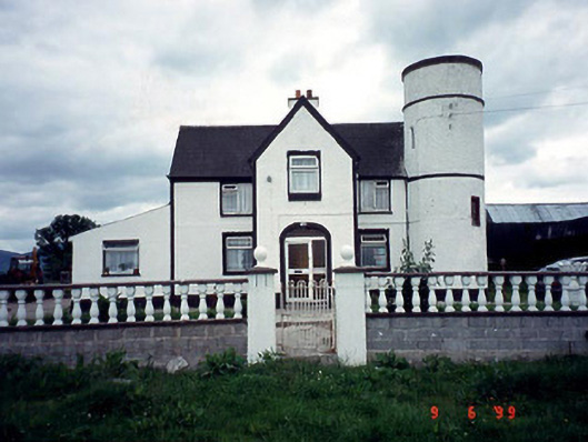 Tower Housefarm house · 2.4 mi
 KnockroeMountain / peak · 2.8 mi
 SlievebaunMountain / peak · 2.9 mi
 The Barrow WayVisitor information · 3.1 mi
 Castle (in ruins)Castle, tower house · 3.5 mi
 ClashgannyWood · 3.7 mi
 Mount LeinsterMountain · 4.4 mi