What is recorded here
Marked on the 1839 and 1925 eds of the OS 6-inch map and described in gothic lettering on both as St. Martin’s Well. It is located c. 15m from the E bank of a small N-S stream on a level, low-lying landscape and c. 100m NE of the site of Rathmacknee church (WX042-029002-). According to John O’Donovan writing c. 1840 the pattern was held for a whole week beginning on the 11th of November, until it was abolished c. 1810 (O’Flanagan 1933, vol. 1, 291). It is not visible at ground level in pasture.
The dedication is to St. Martin of Tours. He was a Christian and a soldier in the Roman army, renowned for his charity. He was a devotee of St. Hillary, bishop of Potiers, who provided him with land for a monastery at Potiers, the first to be built in Gaul, and in 371 Martin became bishop of Tours. He continued to live a severe monastic life, founding the monastery of Marmoutier at Tours, and he died in AD 397. (Butler 1883, 161)
Compiled by: Michael Moore
Date of upload: 28 May, 2013
Amended: 15 January, 2014
St. Martin’s Well is associated with St. Martin of Tours, a 4th-century Christian saint known for his acts of charity and conversion. Traditionally, holy wells dedicated to him were often visited for cures related to skin ailments and protection from fire or war.
The monument record does not grant public access. Check the route and ask the landowner before entering private land.
- What survives
- Recorded monument
Places near here
 CastleCastle, tower house · 85 yd
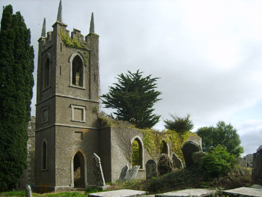 Saint John's Church (Rathmacknee)church/chapel · 100 yd
 Site of ChurchChurch · 110 yd
 bridgebridge · 213 yd
 Not idnicatedChurchyard · 1614 yd
 Johnstown Castle Visitor CentreHeritage attraction · 1.7 mi
 Irish Agricultural MuseumMuseum · 1.7 mi
 Japanese cedarJapanese cedar · 1.7 mi
 American SweetgumAmerican Sweetgum · 1.8 mi
 Ballyrane Castle (in ruins)Castle, tower house · 1.9 mi
 16th Irish DivisionMemorial · 3.7 mi
 1798 Memorial PlaqueMemorial · 3.7 mi