What is recorded here
Mud and muscle built these lines in County Fermanagh during the sixteenth century, forcing living people into shapes that mathematics would later call rational. Distance and danger made the rules; the human body supplied the rope. What looks like a casual mark may have cost weeks of breath and warning.
The official Northern Ireland record identifies this as SIEGE WORKS. Recorded period: C16TH; POST-MED. The official map point was placed at the centre of the recorded archaeological site from the source map reference.
The monument record does not grant public access. Check the route and ask the landowner before entering private land.
- What survives
- Recorded monument
Places near here
 Thistlebank HouseHouse · 137 yd
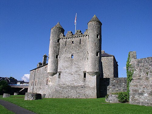 Enniskillen CastleCastle · 138 yd
 ENNISKILLEN CASTLE in EnniskillenENNISKILLEN CASTLE · 165 yd
 Fermanagh County MuseumMuseum · 179 yd
 Castle IslandIslet · 195 yd
 Boer War MemorialMemorial · 242 yd
 Methodist Church HallHall · 330 yd
 C18TH CHURCH with C17th TOWER, & GRAVEYARD: ENNISKILLEN CHURCH in EnniskillenC18TH CHURCH with C17th TOWER, & GRAVEYARD: ENNISKILLEN CHURCH · 460 yd
 Cherry IslandIsland · 602 yd
 FORTIFICATIONS in EnniskillenFORTIFICATIONS · 888 yd
 Remembrance Day bombingbomb attack · 895 ydSiege of Enniskillensiege · 925 yd