What is recorded here
Killamery was a real town in medieval Kilkenny, held by the Tobins from at least 1247 and still named in Ormond deeds by 1584. Its motte and parish church marked the heart of a working manorial centre, not a phantom settlement. James Tobin lost it after the 1641 Rising, and the town vanished from later maps. The land remembers what human pride forgot: Killamery was inhabited, taxed, granted and taken before silence swallowed its streets.
Empey (1990, 85) lists Killamery as a town in his map of the medieval county of Kilkenny. The presence of a motte (KK030-008001-) suggests that at the very least it was a manorial centre. According to Carrigan (1905, vol. 4, 317), ‘the townland of Killamery having been acquired by the Earls Marshall, about the beginning of the 13th century, was granted by them, as a feudal tenancy, to the Tobins, or De St. Albin’s, Lords of Kaemshinagh. On the 30th April, 1247, it was held by Thomas de St. Albin from Richard de Clare, Earl of Gloucester and Hertford’. Killamery is mentioned several times in the Calendar of Ormond Deeds, the King being due ‘Half a knight’s fee in Kyllamery’ in c. 1399 and in c. 1413 the Royal service from ‘Kilamery’ amounted to 20 shillings (Curtis 1934, vol. 2, 236; 317). In 1584 the Ormond Deeds mention ‘Walter McRichard Tobin of Kilamery, Co. Kilkenny’ in relation to land grants (Curtis 1970, vol. 6, 14). Killamery was eventually forfeited by James Tobin following the 1641 Rising (Carrigan 1905, vol. 4, 317). The precise location of the medieval settlement is unknown, though it would have centred on the motte and parish church (KK030-008003-).
Compiled by: Jean Farrelly
Date of upload: 20 July 2017
The monument record does not grant public access. Check the route and ask the landowner before entering private land.
- What survives
- Recorded monument
Places near here
 Stone CrossCross, High cross · 25 yd
 Bullaun stone in KillameryBullaun stone · 27 yd
 Killamery High CrossVisitor information · 33 yd
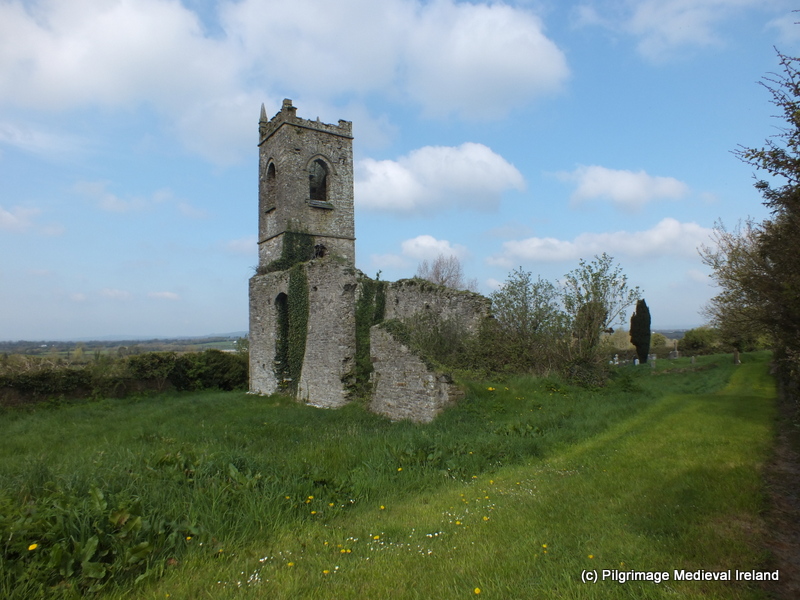 Church (in ruins)Church · 70 yd
 Saint Nicholas's Church (Killamery)church/chapel · 75 yd
 IndicatedCastle, motte · 106 yd
 KillameryVisitor information · 143 yd
 Bawn in GarryrickinBawn · 1.1 mi
 The SpoutMemorial · 1.4 mi
 James (Jim) McKennaMemorial · 1.6 mi
 HawthornHawthorn · 3.2 mi
 European ashEuropean ash · 3.6 mi