
What is recorded here
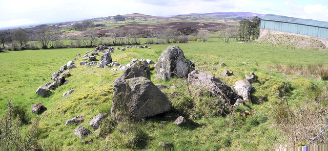
In pasture on the S side of Lough Gur 80m NE of the medieval church and graveyard (LI032-024001/2-) and 22m E of a limekiln. The road/trackway is orientated roughly N-S and can be traced from the lake edge to a point 30m SW of the fort known as Carriggalla or Carriganaffrin (LI032-028----). The line of the trackway crosses the Red Bog from the NE to SW where the line of the road can be traced 130m W of an enclosure (LI032-186----) in Ballynagallagh townland. The road survives as far S as Kilballyowen townland where it is 170m NE of an earthwork (LI032-217----).
The road is not depicted on the OSi historic maps. Sections of the road are visible on OSi orthoimage taken 2005-12, however it is less clear on the Digital Globe orthoimages taken 2011-2013. The N section of the road is described and illustrated by Crofton Croker (1833, 109), he states that it is ‘a serpentine passage formed by parallel stones, which terminates in the Red Bog’. The linear earthwork is visible on Google Earth orthoimage taken 28/06/2018 as a slightly sunken road (ext. diam. 9m) lined on either side by low bank.
See attached Google Earth orthoimages
Compiled by: Edmond O’Donovan
Date of upload: 12 November 2020
The monument record does not grant public access. Check the route and ask the landowner before entering private land.
- What survives
- Recorded monument
Places near here
 Stone CirclesSettlement platform · 102 yd
 Grave YardGraveyard · 125 yd
 New Church (in ruins)Church · 142 yd
 Black Castle (in ruins)Castle, tower house · 464 yd
 Church (in ruins)Religious house, Augustinian nuns · 841 yd
 Garret IslandCastle, unclassified · 886 yd
 Pedunculate OakPedunculate Oak · 1134 yd
 Grange Stone CircleArchaeological place · 1215 yd
 Lough GurVisitor information · 1281 yd
 Lough Gur Heritage CentreVisitor information · 1464 yd
 The SpectaclesVisitor information · 1537 yd
 Glen BogForest · 1.6 mi
Other information
Photo: Credit not shown in the picture search · Rights wording not checked; contact us if this picture should be removed