What is recorded here
Red Trail is recorded as a named walking route on the public map.
A mapped walking route does not guarantee present access or safe conditions. Check signs, closures and the weather before setting out.
Places near here
 Pretty Corner WoodsVisitor information · 447 yd
 Church of All SaintsListed building · 1335 yd
 Upper Sheringham War MemorialListed building · 1349 yd
 West and East BeckhamVisitor information · 1558 yd
 The BowerHeritage attraction · 1.0 mi
 The TempleHeritage attraction · 1.0 mi
 Sheringham WoodWood · 1.1 mi
 Beeston Regis PrioryScheduled monument · 1.1 mi
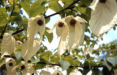 The Handkerchief TreeHandkerchief Tree · 1.1 mi
 Beeston Regis Village SignMemorial · 1.2 mi
 Sheringham War MemorialMemorial · 1.3 mi
 The Smuggler's Cave, SheringhamCave or cavern · 1.3 mi