What is recorded here
Indicated is a ruined stone ringfort on a Kerry ridge above Lough Currane, its entrance buried under centuries of cleared rock and green growth. Inside the choked circle, three narrow underground passages still cut through the earth, roofed with flat slabs and joined by tiny creepways that demand a person bend low or crawl forward. The fort may have been a home, a refuge or a boundary marker, but its visible walls no longer give the answer. What remains is a stone mouth half-swallowed by the field, keeping its shape hidden while the lake waits below.
Internal diam. 16.5m N-S, 16m E-W
Located on the crest of a low ridge that overlooks Lough Currane to SE, this circular caher is poorly preserved. A large amount of field clearance material has been dumped against and on top of its enclosing element, obscuring it in part. The wall averages 2.7m wide, but with clearance material and overgrowth it is now up to 6m wide in places. It has an average internal height of .5m, an external height of 1.6m and consists of inner and outer drystone facing enclosing a rubble core. The entrance to the site is not apparent, and dense vegetation conceals much of its interior. The possible foundations of a circular hut, 4m in overall diameter, are located in its SW quadrant.
An opening to a Man-made underground passage (KE098-009002-), .7m x .6m, is located in the NW quadrant of the site. This gives access to the N end of a N-S aligned passage which is 3.3m long. Measuring .8m wide and .8m high, its sides are of earth and it is roofed with stone slabs. At its S end is a lintelled creepway, .5m x .3m, which leads into the second passage. The latter is aligned NNE-SSW and is 4.7m long. Measuring 1.3m high and .5m wide, it is of similar construction to the first passage. At its SSW end is a lintelled creepway, .5m x .3m, which gives access to a third passage. Now inaccessible, this is aligned E-W and is c. 3m long. Its side-walls are of coursed drystone masonry, with intermittent upright slabs, and it is roofed with slabs. O'Connell gained access to the Man-made underground passage through an opening in the E end of this passage (OPW, 1937). This opening was located in the 'SE outer wall' of the caher, and is now concealed by field clearance material.
The above description is derived from A. O'Sullivan and J. Sheehan (compilers), 'The Iveragh peninsula: an archaeological survey of South Kerry'. Cork University Press (1996), no. 619. In certain instances the entries have been revised and updated in the light of recent research.
Date of upload: 29 July 2013
The monument record does not grant public access. Check the route and ask the landowner before entering private land.
- What survives
- Recorded monument
Places near here
 Indicated (1846).Fairy fort / earthen ringfort · 369 yd
 SheepfoldHut site · 850 yd
 Iveragh Lodgehunting/fishing lodge · 1160 yd
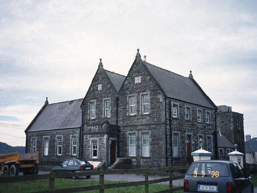 The Cable Stationcoastguard station · 1295 yd
 Butler MemorialMemorial · 1639 yd
 T. C. Millerick MemorialMemorial · 1.1 mi
 Waterville PromenadeWalking route · 1.1 mi
 CastleCastle, tower house · 1.5 mi
 Inny StrandBeach / strand · 1.7 mi
 Reenrow BeachBeach / strand · 2.5 mi
 Emlagh LoopWalking route · 2.6 mi
 An Bheann MhórMountain / peak · 3.0 mi