
What is recorded here
According to Power (1905, 123) an ancient road running between Lismore and Ardmore crossed the N-S River Blackwater at a ford (WA029-012----), which brought it to Affane (WA029-013----). From here a branch extended E (L c. 3.5m) towards Whitechurch along public and private roads (Power 1905, 123-4). It is described as 'Boreen na Naomh' on the 1840 ed. of the OS 6-inch map and from its E end there is a gap (L c. 1km) before a final short stretch (L c. 100m) (WA030-011----) leads to the Finisk River at Whitechurch bridge (ibid. 124).
However, from Affane another route to Ardmore turned SE (WA029-015----) on the line of the public road to Kilmolash church (WA029-027001) (L c. 3km) (ibid. 124) and further south along lesser roads to Woodstock (L c. 1.3km) where farm lanes take it E to Knocknaskgh (L c. 1.4 km). At this point, farm lanes extending N (L c. 1km) to Knocknaskagh cross-roads and N to Whitechurch (L c. 1.1km) on the line of the Clonmel road (R671). At Whitechurch it would meet the discontinued line from Affane. From the meeting point in Knockanskagh a farm lane runs SW (L c. 900m) to a minor road in Keereen Upper. From here the runs SW past the moated site (WA029-052----) (L c. 800m ) and on to Curraheen townland (L c. 1km). From here farm lanes continued the route through Curraheen, Ballycullane, and Graigue, to Goish Bridge (L c. 2.5 km) (ibid. 124).
Power, Rev. P. (1905) The Rian bó Phadruig (the ancient highway of the Decies) JRSAI 35, 110-29.
Compiled by: Michael Moore
Date of upload: 26 July 2011
The monument record does not grant public access. Check the route and ask the landowner before entering private land.
- What survives
- Recorded monument
Places near here
 Affane National Schoolschool · 1461 yd
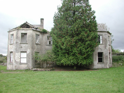 Affane Housecountry house · 1488 yd
 Battle of AffaneMajor battlefield · 1545 yd
 Grave YardGraveyard · 1562 yd
 CastleCastle, unclassified · 1.1 mi
 Dromana GateHeritage attraction · 1.1 mi
 Font in KilmolashFont · 1.4 mi
 Coillte infoboardVisitor information · 1.6 mi
 Tourin CastleCastle, tower house · 1.9 mi
 London PlaneLondon Plane · 1.9 mi
 Dromona HillMountain / peak · 2.0 mi
Other information
Photo: Credit not shown in the picture search · Rights wording not checked; contact us if this picture should be removed