Add the human story, a picture, a first-hand message or a missing place.
Earn 5 points after the picture is checked and accepted.
Add a pictureAdd its storyTalk or ask a questionAdd a new placeWhat is recorded here
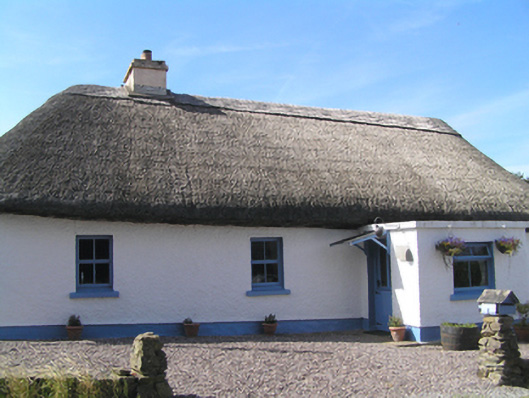
Detached four-bay single-storey thatched house, built c. 1780, having single-bay flat-roofed porch to front (north) elevation and full-width flat-roofed extension to rear (south) elevation. Hipped thatched roof with rendered chimneystack. Roughcast rendered walls with smooth rendered plinth. Square-headed openings with replacement timber casement windows, uPVC window to west elevation. Square-headed opening with timber battened half-glazed door. Two-bay single-storey outbuilding to west having pitched corrugated metal roof, rendered walls and square-headed openings with timber casement window and replacement timber panelled half-glazed door. Two-bay single-storey outbuilding to east having lean-to roof, rubble stone walls, and square-headed openings with fixed timber window and timber panelled door. Single-bay single-storey outbuilding to rear with pitched corrugated-iron roof, rubble stone walls and square-headed opening.
This official record and map point do not grant access. Most recorded buildings are privately owned; view them only from public ground unless the owner allows entry.
Conversation about this place
Questions and messages sit beneath the source record. They are checked before appearing.
No questions or messages yet.
Ask a question or join the conversation