Add a picture, leave a message or tell me about a missing place.
Earn 5 points after the picture is checked and accepted.
Add a pictureShare what you foundAdd a new placeWhat is recorded here
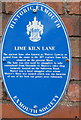
This blue commemorative plaque records: Lime Kiln Lane. The ancient lane, also known as Watery Lane, is so named from the route to the 18th century lime kiln situated on the present Maer. The lane was also used by smugglers to take contraband from Orcombe to Mutter's cider shop formerly located on the Salterton Road. Mutter was a local smuggler after whom Mutter's Moor was named which was the location of one of his look-out points near Sidmouth. Recorded plaque organisation: Exmouth Society.
A plaque record does not grant entry to a building or private land. View it from a public place unless permission is clearly given.