Add a picture, leave a message or tell me about a missing place.
Earn 5 points after the picture is checked and accepted.
Add a pictureShare what you foundAdd a new placeWhat is recorded here
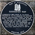
This black commemorative plaque records: Gloucester Quay Gloucester owes much of its early prosperity to its location on the River Severn and received formal status as a port through a Royal Charter of 1580. The old quay was much frequented by sailing trows and barges working between Bristol and Shrewsbury, and continued to be used well into the 20th century. The present quay wall was constructed in 1887-8. Recorded plaque organisation: Port of Gloucester.
A plaque record does not grant entry to a building or private land. View it from a public place unless permission is clearly given.