Add a picture, leave a message or tell me about a missing place.
Earn 5 points after the picture is checked and accepted.
Add a pictureShare what you foundAdd a new placeWhat is recorded here
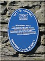
This blue commemorative plaque records: Boundary Wall. This marked the limit of the town from its medieval origins until 1835, when its first extension took in the workhouse (now part of St Woolos Hospital) and Pillgwenlly Recorded plaque organisation: Newport Civic Society, Newport Council.
A plaque record does not grant entry to a building or private land. View it from a public place unless permission is clearly given.