Add a picture, leave a message or tell me about a missing place.
Earn 5 points after the picture is checked and accepted.
Add a pictureShare what you foundAdd a new placeWhat is recorded here
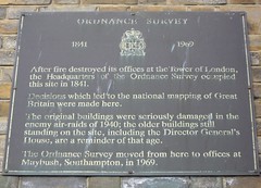
This bronze commemorative plaque records: Ordnance Survey 1841 - 1969 After fire destroyed its offices at the Tower of London, the Headquarters of the Ordnance Survey occupied this site in 1841. Decisions which led to the national mapping of Great Britain were made here. The original buildings were seriously damaged in the enemy air-raids of 1940; the older buildings still standing on the site, including the Director General's House, are a reminder of that age. The Ordnance Survey moved from here to offices at Maybush, Southampton, in 1969.
A plaque record does not grant entry to a building or private land. View it from a public place unless permission is clearly given.