Add your own picture and explain the route, parking, gates, paths or landmarks that help people find it.
Earn 5 points after the picture is checked and accepted.
Add your photo and local directionsShare what you foundWhat is recorded here
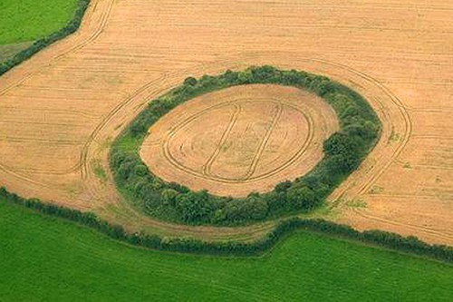
In pasture, on SE-facing slope of prominent rise of ground with good views to the S, W and N. On the 1837 ed. OS 6-inch map the monument is depicted as a hachured circular enclosure with small rectangular annexe or field adjoining SSW side. This annexe or small paddock is not depicted on the revised 1910 ed. OS 25-inch map. Circular area (diam. 35.4m N-S; 37.4m E-W) defined by an earthen bank mainly reduced to a scarp with a wide, deep external fosse and a large well preserved external bank with slight traces of an external fosse. Causewayed entrance gap (Wth 2.8m) at SE. A large quarry hole cuts into the outer bank of the ringfort at N. Modern gap in the bank at WNW. A section of the external bank has been removed at SSE. OSI aerial photograph from 2005 shows the monument is now located in the centre of a coniferous plantation.
Compiled by: Caimin O’Brien
Date of upload: 25 July 2013
This remains an important historical record, but the official description says the monument is no longer visible or has been destroyed.
The monument record does not grant public access. Check the route and ask the landowner before entering private land.