Add your own picture and explain the route, parking, gates, paths or landmarks that help people find it.
Earn 5 points after the picture is checked and accepted.
Add your photo and local directionsShare what you foundWhat is recorded here
This church and graveyard is situated inside a large possibly trivallate ecclesiastical enclosure (WM032-089002-) which was discovered in 2004 as part of the archaeological excavations of the route of the N6 from Kinnegad to Kilcock. This monument may be the remains of the monastery known as Cluain-fota-Baethain which was associated with a Bishop Etchen who died in 578-84 AD and who was supposedly ordained by St Colmcille (Gwynn & Hadcock 1970, 376). A second monastic site within the townland of Rattin which contains the earthworks of a monastery, a church and graveyard, a High Cross and a Bishops Grave (WM027-066001/002003/004/005; WM027-067001/002-) and is located adjoining the townland of Clonfad in Farbill Barony has been traditionally identified as the site of Clonfad Monastery. It is possible that the OS may have been incorrect in assigning the sixth century monastic designation to the ecclesiastical remains at Rattin. Alternatively there may have been two early medieval monastic foundations at Rattin and at Clonfad in the barony of Fartullagh. The archaeological remains at the latter confirm the existence of an impressive early medieval monastic foundation which may be the remains of Clonfad Monastery. The monastery of Clonfad is mentioned in the Annals of the Four Masters in the year 887 when it records that 'Conchobhar, son of Flannagan, lord of Ui-Failghe, was destroyed by fire at Cluain-foda-Fini [Clonfad] and the relics of Finian were violated by the Feara-Tulach' (O'Donovan 1856, vol. 1, 541). In 1418 John Omigaid was assigned to the rectories of ‘Cluainfada’ and Newtown (Villenove) de Feartulach in the diocese of Meath which had been vacant since the death of Richard Ochallam (Twemlow 1904, 478).
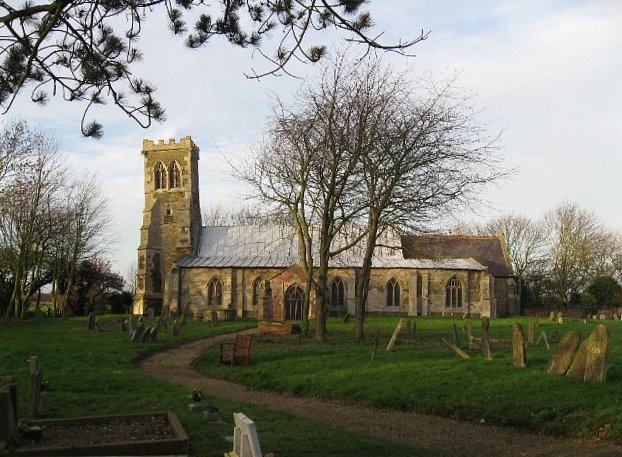
The present medieval church may have been built on or near to the site of the early medieval church of Clonfad. The late medieval stone church was described in 1981 as 'The ruin of a long rectangular building measuring approx. 6.5m wide by approx. 21, long. The building is aligned ESE-WNW. The greater part of the north wall has collapsed. The west wall and part of the south wall remain in a ruined and ivy covered state. The eastern end is completely ruined and a low wall cuts off the east end approx. 12.5m from the west. This appears to be a relatively modern wall probably built to enclose a private burial area. The interior of the church is overgrown and filled with fallen trees and as a result is inaccessible. No decorative features can be seen . To the NE of the church in the graveyard (WM032-089001-) is a roughly shaped piece of limestone circular in section 50cms wide at the base and tapering to a circular flat top approx. 25cms wide. The stone is 45cms high. There is no hole or other feature which might indicate a purpose for the stone. The church is enclosed in a small graveyard by a roughly circular stone wall. The surrounding field has recently been cleared and ploughed. There are no remains of earthworks' (SMR file 1981). In 2009 the monument was entered into the Register of Historic Monuments (1/2009).
Compiled by: Caimin O'Brien
Date of upload: 6 September 2010
This remains an important historical record, but the official description says the monument is no longer visible or has been destroyed.
The monument record does not grant public access. Check the route and ask the landowner before entering private land.