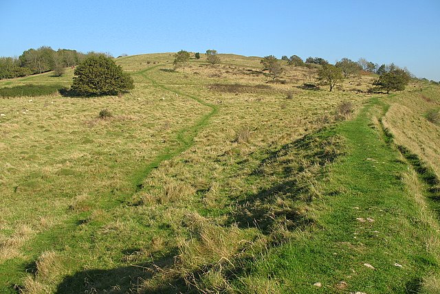
Add your own picture and explain the route, parking, gates, paths or landmarks that help people find it.
Earn 5 points after the picture is checked and accepted.
Add your photo and local directionsShare what you foundWhat is recorded here
On the top of Spinans Hill c. 1.5km NW of Brusselstown Ring and within the Spinans Hill hillfort complex (WI021-080001-/WI027-078001-). The remains of a large irregularly shaped area (550m N-S; 320m E-W) enclosed by a peat-covered earthen bank, best preserved at N and E and largely levelled over the remainder of its course. Visible on aerial photographs (OSi c. 2005: Accessed 19 December 2012; Google Earth, Accessed 19 December 2012, Imagery date 16 April 2003). Within this hillfort is a large cairn (WI021-080004-), and five smaller ones (WI021-080003-, WI021-080006-, WI021-080007-, WI021-080008-, and WI021-080009-). GPS survey by O'Driscoll in 2014. (Condit 1992, 20)
The hillfort was recently described in the Atlas of Hillforts of Britain and Ireland as following; 'Contour fort positioned in commanding position on domed E summit of Spinans Hill at SW edge of Wicklow mountains. Spinans Hill 1 is one of nine hillforts comprising the Baltinglass hillfort cluster. Univallate for its entire circuit and forming a complete circuit, it has a total site footprint of approximately 11.1ha. There are no recorded entrance features. Condit (1992, 20; 1998, 20) has recorded what he interprets as a Neolithic passage tomb cemetery within the interior of the hillfort. This comprises a large central cairn positioned at the summit of the hillfort, surrounded by five smaller examples. The ramparts survive best to the E. Interior heavily overgrown with scrub and heather. First identified by Condit in 1992. Monument survey by Condit in 1998. GPS survey by O'Driscoll in 2014. Center of the hillfort is bisected by the boundary between the townlands of Spinans Hill and Ballyhubbock Upper. The interior of this hillfort is overgrown with heather, making identification of low relief ground features difficult. No habitation evidence has been identified within the interior. Condit (1992, 19 _ 20) has recorded six cairns at its centre. A large central cairn positioned at the summit of the hillfort is surrounded by five smaller examples. This group of cairns has been interpreted by Condit (1992, 20; 1998, 20) as a possible passage tomb cemetery. Structural features at the centre of the smaller cairns indicate that these may well be megalithic tombs. Price identified ruined cists in several robbed out smaller cairns (in Corlett and Weaver 2002, 467). Spinans Hill 1 is defined as an irregularly shaped area enclosed by a peat-covered earthen bank occupying 11.11ha. The bank is best preserved at the N and E and is largely levelled over the remainder of its perimeter (Grogan and Kilfeather 1997, 40 _ 41). It was identified through aerial photography by Condit (1992). Price had previously noted an element of the hillfort but did not identify it as such (in Corlett and Weaver 2002, 538 _ 539).' (http://hillforts.arch.ox.ac.uk/records/IR0726.html)
Compiled by: Mary Tunney
Revised by: Caimin O'Brien
Date of revised upload: 7 February 2020
The monument record does not grant public access. Check the route and ask the landowner before entering private land.