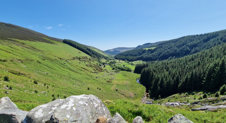
Add your own picture and explain the route, parking, gates, paths or landmarks that help people find it.
Earn 5 points after the picture is checked and accepted.
Add your photo and local directionsShare what you foundWhat is recorded here
Multi-vallate hillfort mainly covered by a modern coniferous plantation encircling the summit of Tinoran Hill (Condit 1992, 15). The inner oval enclosure (dims. 50m NW-SE; 45m NE-SW), marked as 'the Round O' on the 1837 ed. OS 6-inch map, is defined by an earth and stone bank (Wth 1.5m; H 0.9-1.2m) with an external fosse (Wth 1.7m; D 0.8m). An internal fosse (Wth 1.5m) is visible at the SW. Both faces of the bank and the outer edge of the outer fosse have dry stone facing (probably not original). The slightly domed interior has been planted with trees. The second enclosing element (indicated as field boundaries on the 1907 OS 6-inch map) is situated just above the 900ft contour and encloses an oval area (dims. c. 450m N-S; 400m E-W). It is surmounted at the W and SW by a low, largely collapsed bank of earth and stone (Wth 4m). The third, outermost rampart, 150m outside this, survives only at the SE in the field boundary (also shown on the 1907 OS 6-inch map). There is a hut site (WI026-004001-) inside the second rampart at the SW, and a ring-barrow (WI026-005----) outside this rampart at the E. Virtually all of this hillfort has been afforested (Price 1949, 150). Using LiDAR mapping, James O’Driscoll (UCC) identified a possible fifth enclosing element Tinoran, located some 50m from the fourth enclosing bank. This is best preserved at S where it is visible as a low bank up to 11.6m wide. When the full extent is calculated, this bank may enclose a total hillfort area of 84.03ha (O'Brien 2015, 3-4).
In August 2015 sample excavation under licence no. 15E0321 was conducted By Prof. William O'Brien of UCC. This is the largest known hillfort in Ireland, with four or possibly five concentric enclosures surrounding an area estimated at 84ha. The excavation was undertaken as part of a research project on prehistoric hillforts in Ireland, based in University College Cork and funded by the Irish Research Council. The investigation at Tinoran consisted of a single trench excavated across the defences of the third in an area of cleared forestry in the SW quadrant of the hillfort. A second trench was excavated across the fourth enclosing bank in an area of open grassland in the SSE quadrant of the hillfort. The results confirmed the presence of a substantial stone bank around the third enclosure, inside which evidence of occupation in the form of burnt spreads and coarseware pottery. The defences of the fourth enclosure are somewhat different, represented by the remains of an earthen bank and ditch that was levelled in modern times. Samples were recovered for radiocarbon dating from both trenches (results pending) (ibid., 1).
The above description is derived from the published 'Archaeological Inventory of County Wicklow' (Dublin: Stationery Office, 1997). In certain instances the entries have been revised and updated in the light of recent research.
Revised by: Caimin O'Brien with details supplied by Professor William O'Brien of University College Cork.
Date of revised upload/revision: 27 January 2017
The monument record does not grant public access. Check the route and ask the landowner before entering private land.