Add your own picture and explain the route, parking, gates, paths or landmarks that help people find it.
Earn 5 points after the picture is checked and accepted.
Add your photo and local directionsShare what you foundWhat is recorded here
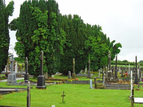
Located towards the bottom of a S-facing slope on the N bank of the Greagagh River at a point where it changes from a NE-SW direction and turns W to join the N-S River Blackwater c. 2.3km to the W. The site of an early church (WA037-008001-) and the site of the parish church of Clashmore (WA037-008002-) are within a rectangular graveyard (dims. c. 100m E-W; c. 60m N-S) defined by masonry walls. It contains of a C of I church that has been converted into a heritage centre. St Mochua’s Well (WA037-007----) is c. 300m to the W.
Archaeological excavation (07E0051) on a small site c. 40m N of the graveyard produced no related material (Lynch 2010b), and testing (06E1088) on a large area (dims. c. 270m N-S; c. 125m E-W) W of the graveyard produced only post-medieval features (Lynch 2009).
Lynch, R. (2009) Clashmore. Post-medieval activity. in I. Bennett (ed.) Excavations 2006: summary accounts of excavations in Ireland, 527-8, No. 1980. Wordwell. Dublin.
Lynch, R. (2010b) Mansfield, Clashmore. No archaeological significance. in I. Bennett (Ed.) Excavations 2007: summary accounts of excavations in Ireland, 513, No. 1810. Wordwell. Dublin.
Power, Rev. P. (1896b) The ancient ruined churches of Waterford. WAJ. 2, 2-15, 195-298.
Compiled by: Michael Moore
Date of upload: 10th November 2011
The monument record does not grant public access. Check the route and ask the landowner before entering private land.