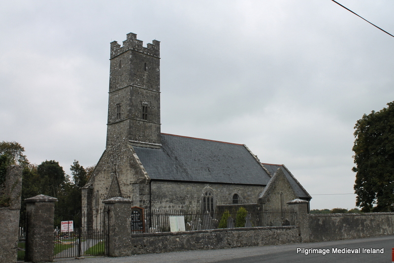
Add your own picture and explain the route, parking, gates, paths or landmarks that help people find it.
Earn 5 points after the picture is checked and accepted.
Add your photo and local directionsShare what you foundWhat is recorded here
Situated at the bottom of the E-facing foothills of the Monavullagh Mountains, c. 350m W of the NW-SE River Tay. The parish church of Kilrossanty (WA023-007001-) is within a D-shaped graveyard (WA023-007002-) defined by stone-faced earthen banks with straight N and E sides. The graveyard is part of a suboval or D-shaped ecclesiastical enclosure (WA023-007008-) (dims. c. 65m E-W; 42m N-S) defined by a curved scarp (H 0.9-1.2m) outside the graveyard NE-SE and the graveyard perimeter S-W.
At the base of the scarp at E are three holy wells. Tober Íosa is at the S and is a wedge-shaped well (dims. 0.75m a 0.0.5-0.7m), whole outflow joins the N-S stream from Tober Mhuire and Tober Iosa. There is no evidence of veneration, but in the 1840s offerings were left at the W wall of the church (O'Flanagan 1929, 36-7). (Power 1897b, 6-9; Power 1938a, 64-5)
O'Flanagan, M. (Compiler) (1929) Letters containing information relative to the antiquities of the county of Waterford collected during the progress of the Ordnance Survey in 1841. Typescript. Bray.
Power, Rev. P. (1897b) The ancient ruined churches of Waterfoed. WAJ 3, 3-12, 72-8; 216-227.
Power, Rev. P. (1938a) Some old churches of Decies, JRSAI, 68, 55-68.
Date of upload: 25th March, 2011. Compiled by: Michael Moore.
The monument record does not grant public access. Check the route and ask the landowner before entering private land.