Add your own picture and explain the route, parking, gates, paths or landmarks that help people find it.
Earn 5 points after the picture is checked and accepted.
Add your photo and local directionsShare what you foundWhat is recorded here
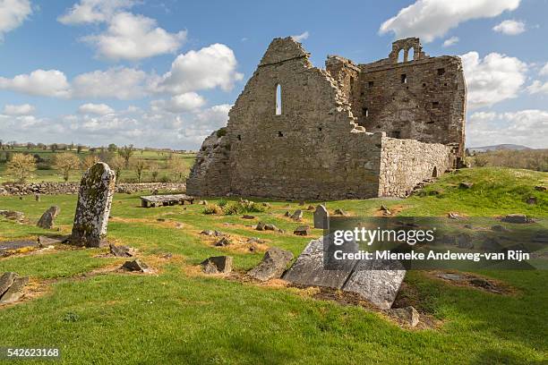
St. Nicholas' church is situated S of the medieval town of Clonmel (TS083-019----), across the River Suir, in open ground on a gentle W-facing slope between St. Nicholas' Lane to the N and Whitening Stream to the S and W, in the Old Bridge quarter of the town. The church is located in the NW quadrant of a sub-rectangular graveyard (TS083-020001-). The popular name for the church is Tempull na Plaighe, the church of the plague, due to the large numbers of plague victims who were buried here from the 14th to the 17th century (Lee 1966, 12-26). The church was in use as late as 1669 and was one of only two churches used for Catholic worship in Clonmel in the post-Restoration period (Lyons 1952, 28). This small church (int. dims. 7.85m x 4.47m; wall T 0.9m) is constructed of randomly coursed sandstone rubble. It was badly overgrown at time of inspection, with graffiti and evidence of burning on the internal W gable. The church was entered through a pointed doorway at the W end of the N wall. There are two single-light windows, one in the W gable and a larger example in the E. There are two small aumbrys, one in the NW angle, the other S of the E window. The W gable, which is surmounted by an ivy-clad bellcote, is in a precarious condition. Lyons (1952, 25) noted the remains of an apparently modern building at the SE angle of the church, co-terminous with the glebe boundary, and suggested it was on the site of a conventual domestic building. This is no longer visible. (Farrelly and FitzPatrick 1993, 66-7).
Compiled by: Jean Farrelly
Date of revised upload: 20 January 2015
The monument record does not grant public access. Check the route and ask the landowner before entering private land.