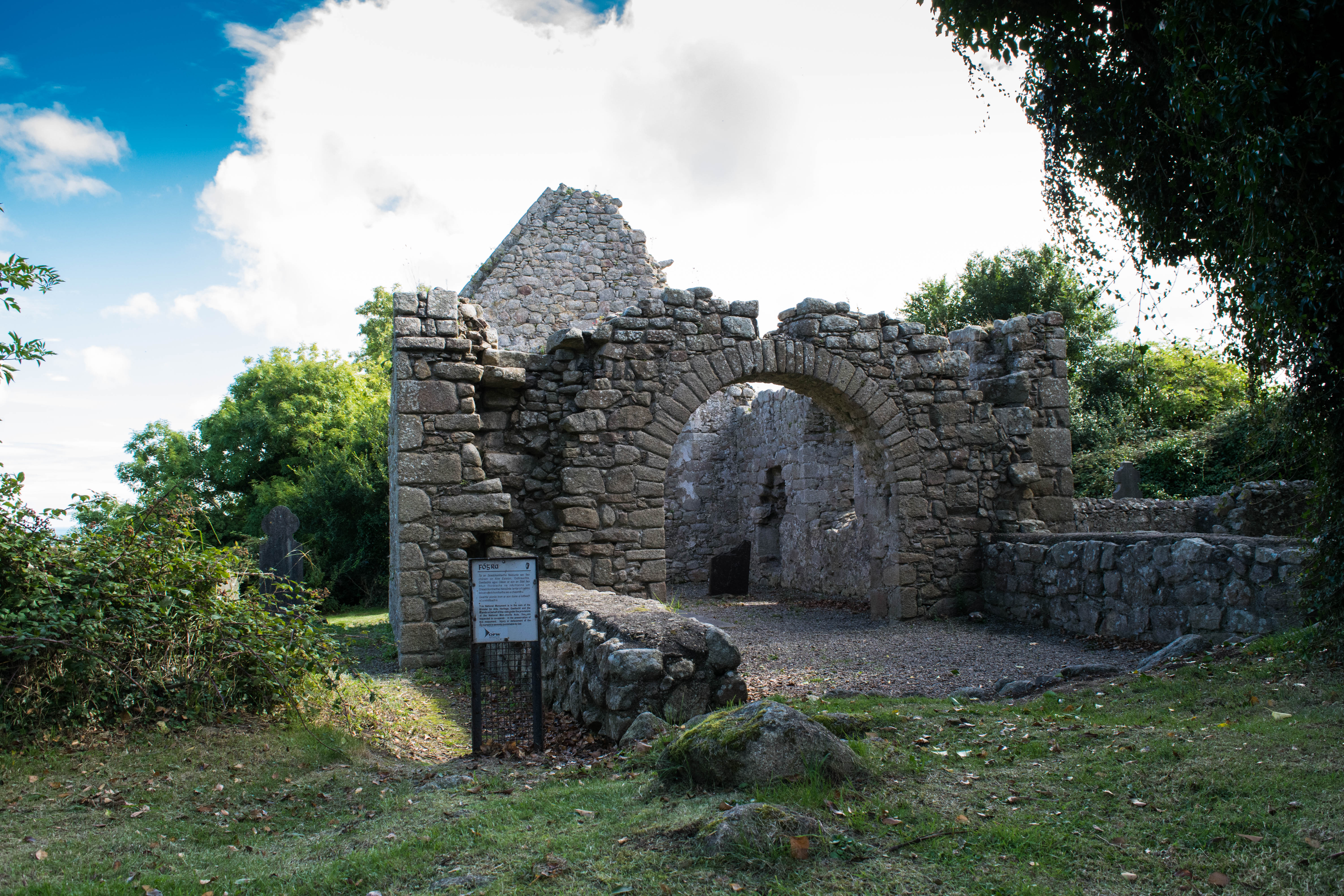
Add your own picture and explain the route, parking, gates, paths or landmarks that help people find it.
Earn 5 points after the picture is checked and accepted.
Add your photo and local directionsShare what you foundWhat is recorded here
On the E slope of a hillock just below the crest of a N-S ridge in pastureland. The church (int. dims. 7.38m N-S; c. 14m E-W to surviving end of S wall - length c. 1840 given as 'about sixty five feet' [19.8m] (O'Flanagan 1930, vol. 3, 80); H of E gable 3.6m; H of N wall 2.9m) is built of roughly coursed limestone rubble with a low base-batter (H 1m above ext. ground level) along the N wall and a high base-batter (2.2m above ext. ground level) on the E gable which is further strengthened by angle buttresses, with well-cut quoins, which are flush with the E gable and project out beyond the N and S wall. The W end of the S wall is also supported by a buttress (Wth 2m; D 0.95m). The W gable and W ends of the N and S walls have not survived. According to the OS Letters (O'Flanagan 1930, vol. 3, 79-80) the church consisted of a nave and chancel 'At a distance of twenty two feet four inches [6.8m] from the east gable, a portion of the middle gable appears, adjoining the north wall, and on the opposite or south side there is a heap of earth mixed with stones'. The church was lit by a two-light window in the centre of the E gable, only the S jambs and half of the sill of which survive. The broken-out sill and a jamb stone lie on the ground 0.75m and 2.2m respectively E of the E gable. There are the remains of a single-light window at the E end of the S wall, but the head is missing. Both windows are chamfered externally. Towards the E end of the N wall there is a break in masonry c. 1.5m above int. ground level, mentioned in the OS Letters as being a window 'much injured on the outside, where it was narrow and filled up with stone-work on the inside' (ibid.). There is a piscina niche at the E end of the N wall with a crude pointed arch, though the piscina itself does not survive. The interior of the church is built up with collapsed masonry, particularly at the E gable where the upper portion of the gable appears to have fallen into the interior and now forms a mound (H c. 1.2m) at the base of the gable. In 2016 a length of walling at the W end of the N wall (L 2.2m; H 1.5m; T 0.96m) was rebuilt after being damaged by a fallen tree. The vegetation was also removed from the interior at this time and a limestone stoup was uncovered. The stoup is hexagonal externally (diam. 0.49m x 0.41m; H 0.33m) with a circular bowl (diam. 0.32m; D 0.23m). Part of the stoup had broken off but has been reunited. The front panel (Wth 0.23m) appears to bear a carving, which, though much eroded, may be of an angel. The two panels on either side (both Wth 0.2m) of this may also have been decorated but are also badly eroded. The back panel (Wth 0.34m) has no trace of decoration, nor do the panels on either side (Wth 0.24-0.25m), though that on the sinister side is badly spawled.
Compiled by: Jean Farrelly
Date of revised upload: 8 November 2016
The monument record does not grant public access. Check the route and ask the landowner before entering private land.