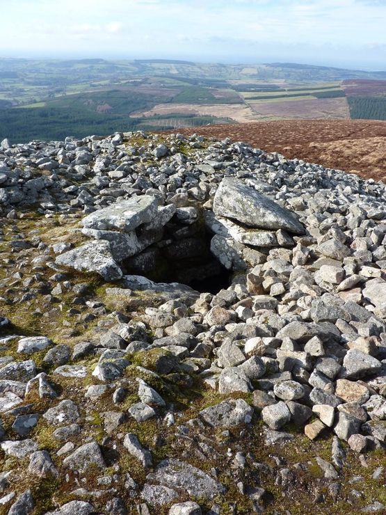
Add your own picture and explain the route, parking, gates, paths or landmarks that help people find it.
Earn 5 points after the picture is checked and accepted.
Add your photo and local directionsShare what you foundWhat is recorded here
Within impenetrable coniferous forestry, on top of SE end of ridge within Kilshane Demesne. According to the Civil Survey (1654-6), ‘On the lands of Swyfine in the s[ai]d. Parish [Killshane] stands a castle in good repayre’ (Simington 1934, vol. 2, 27). The OS Letters (1840) description mentions, ‘a small portion of a stone wall….on the summit of the hill, belongs to a Castle that formerly stood here and was called Caislean Suidh Finn, that is the Castle of Seefin. This portion stands near the northern extremity on the top and is twelve feet [c. 3.65m] long running from east to west and in the middle on the south side is four and a half feet [c. 1.36m] high from the present surface of the ground. At the east end two feet [c. 0.6mm] of the present length (twelve feet) rise only one and a half feet [c. 0.45m] over the surface of the ground on the south side and two feet [c. 0.6m] at the west end, only one foot [c. 0.3m]. This south side of the wall is much injured, the stones being all removed out of the surface which renders it impossible to ascertain the original breadth. The present breadth at east end does not exceed four feet [c. 1.2m]. The surface of the wall on north side remains uninjured, at which side it encloses the south end of the oblong apparently excavation, which measures on east and west sides fourteen feet [c. 4.3m] and on north side eight feet [c. 2.4m] and is sunk about seven feet [c. 2.1m] below the surface of the ground, which added four feet [c. 1.2m], the height of the wall on south side, make its height on north side to be eleven feet [c. 3.3m]. It cannot be easily distinguished now whether this hollow be the space occupied by the Castle, which in this case must have been a small structure, or a space taken up in some apartment belonging to it. An ash tree growing within it and overtopping the wall in the present state, embraces nearly the whole space with its spreading branches. Briars and nettles are seen growing in the north end. It cannot be ascertained by a person standing over this hollow whether the sides and north end are built in it with mason work or not. In the east side are seen large stones apparently in a natural position. There was no means of descending into it and ascending back when the collector of these notices was on the ground. The north surface of the wall that remains here indicates that the castle was well constructed and a strong building. The stone used in the erection of it seems to be the same kind with that exposed to view in the north east extremity of the hill, where there was, it appears, a quarry worked some time ago. The cement used was lime and sand mortar with grouting. Near this spot and at the eastern base of the hill is a clump of wall, the same in all appearance, with respect to materials, as the Castle wall above noticed. This either fell from the ruins of the old building on the summit and rolling along the declivity on this side, rested here in its present position, or perhaps, belonged to a wall that was built on the ascent from the base to the top and joined the Castle there’ (O’Flanagan 1931, vol. 2, 112-14 (308-12). Access was not gained (July 2006).
Compiled by: Jean Farrelly
Date of upload: 16 June 2014
The monument record does not grant public access. Check the route and ask the landowner before entering private land.